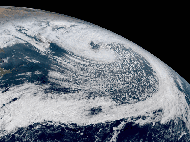
 Bomb storms
Given the right conditions, low-pressure systems can sometimes experience rapid intensification. This is called explosive cyclogenesis. It is driven by an extremely rapid drop in pressure within an extra-tropical cyclone. Generally, an explosive low or “meteorological bomb” designation is given to lows that have a pressure drop of at least 1 millibar per hour for 24 hours (10 millibars per six hours in the North Atlantic). One of these storms may be fully developed within 24 hours.
Explosive lows are primarily maritime phenomena with maximum occurrences between October and May. These storms generate large seas quite rapidly and move at great speeds (winds up to 150 knots with speed of advance of more than 40 knots). They average 10 to 15 degrees of latitude in diameter. Contrast this with tropical storms that take many days to develop, traveling at roughly 15 knots.
Due to their rapid formation, weather models can lag in forecasting development. Fortunately, the occurrence of such lows is rare as compared to normal low-pressure development.
Conditions favorable for development:
• Low-pressure wave developing on a stalled stationary front (forecasted low of 995 or deeper forecasted). Stationary front separating two distinct air masses.
• Wave developing in an area known for explosive cyclogenesis: the Atlantic Ocean off Cape Hatteras, the Northeast Coast of the U.S., and the sea to the west of Ireland, off Japan’s east coast, mid-Pacific between 160° W to 170° W, and the Gulf of Alaska.
• Favorable time of the year (October through May).
• Strong jet stream in upper air (> 110 knots) within 300 NM of low. Jet stream speed should be increasing over time (upper air height contours tightening).
• 500 millibar height contours over low dropping in height. A long wave trough over a surface low.
• Strong shortwave trough moving through the upper air pattern near the developing low that will deepen an existing longwave trough.
• Strong positive vorticity at the S00MB level (+17 or greater on the vorticity index).
• Introduction of very cold, dense air into the low (especially a weak relatively warm and moist core low) leading to a sharp temperature gradient.
• High moisture content in atmosphere (latent heat of condensation provides an energy source for the low).
• Upper air trough located near frontal wave. Troughs enhance the development of counterclockwise airflow. Waves forming near upper air ridges are less likely to intensify since ridges tend to retard counterclockwise or cyclonic motion (Northern Hemisphere).
• Positive vorticity or tendency to spin cyclonically in the atmosphere. This may be caused by land features such as mountains, or upper air features such as shortwave troughs.
• Process continues until stability is restored along the boundary between the air masses.
• Regions of the Northern Hemisphere known for extra-tropical cyclogenesis: the Western Pacific off of the Japanese east coast, Central Northern Pacific, Gulf of Alaska, East Coast of the U.S. off of Cape Hatteras and the waters between Iceland and the British Isles.

