The World Meteorological Organization (WMO) recently announced the entrants to the “Hall of Fame” for the 2023 season. It’s not really called the Hall of Fame, but rather it is the WMO Hurricane Committee deciding which names will be retired from the previous season and not used again moving forward. The retirements of names occurs when a system is unusually impactful. Typically this means that the system was quite strong, and that it also impacted a large population. Occasionally, though, a system’s name can be retired even if it was not an unusually strong system, but its impacts were still very significant.
There are lists of names for each region of the globe where tropical cyclones regularly occur. For the Atlantic and the eastern Pacific there are six lists of names used, each list is assigned to a particular year. The lists are then reused every seventh year. This means that the lists of names which were used in 2023 will be used again in 2029. For the central Pacific region, which includes Hawaii, there are only four lists which are used, and these lists are not assigned to a particular year. Instead, the naming of systems for a new season just continues from the list in the previous season, using the next name in that list. If the end of a list is reached during the season, then the naming moves to the start of the next list. This works well for this region because there are usually far fewer systems there.
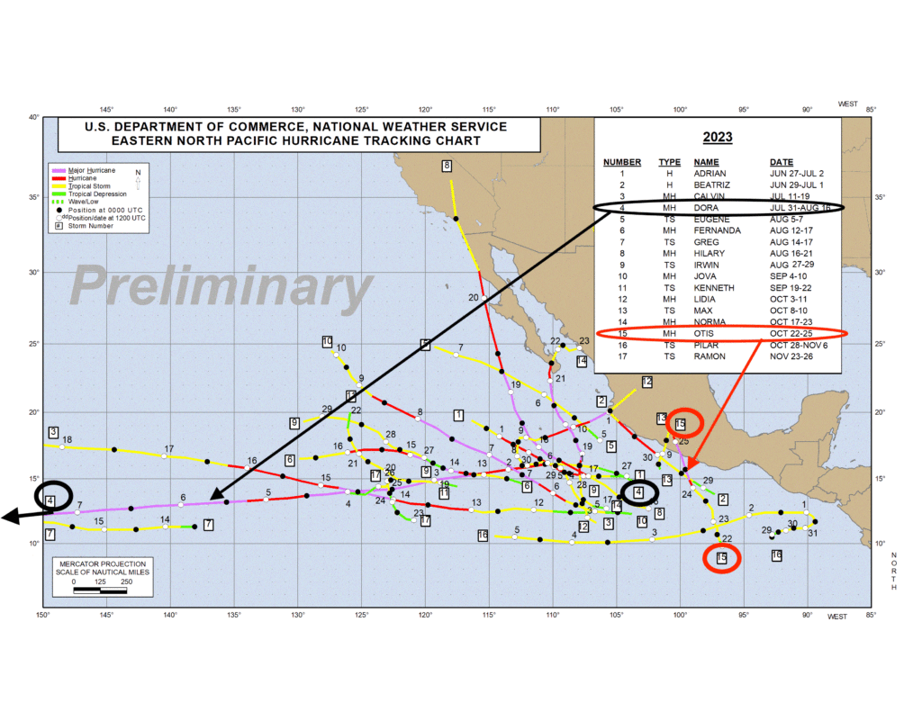
For 2023, there were two names retired for the eastern Pacific region. First, Dora was retired as this system had an indirect impact on the devastating wildfires in Hawaii in August. The other name that was retired was Otis, which underwent an unprecedented rapid intensification in October before making a direct hit on Acapulco in Mexico with catastrophic impacts. Newsletters about both of these systems were written last year shortly after they occurred, and for more information these newsletters can be accessed in the archive. Figure 1 shows the tracks of all the tropical systems in the eastern Pacific for 2023.
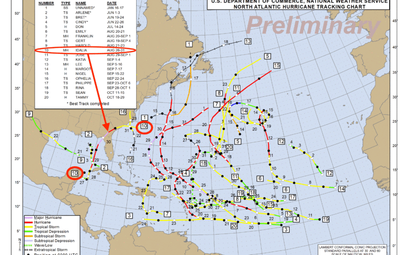
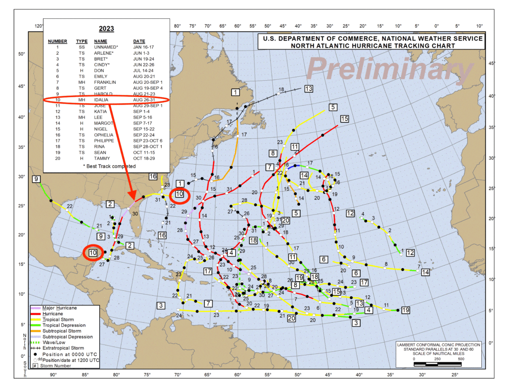
For the first time since 2014, there were no names retired from the Atlantic list. Even though there were 22 systems in the Atlantic in 2023, including 7 hurricanes, 3 of which were major hurricanes, only one system made landfall in the U.S. as a hurricane. Idalia made landfall in the Big Bend region of Florida and did produce significant damage along with 12 fatalities (most of which occurred from individuals interacting with rough surf), but the level of its impact was not generational in nature, so the name was not retired. Figure 2 shows the tracks of all the tropical systems in the Atlantic for 2023.
There were also no names retired from the central Pacific list because no names were used from that list in 2023. This does not mean that there were no tropical cyclones in that region, just that none developed in that region. If a tropical cyclone develops and is named in the eastern Pacific region, then tracks into the central Pacific region, it keeps the name that was assigned in the eastern Pacific region. This is what occurred with Dora, and also a few other systems in 2023. The last time a tropical system developed in the central Pacific region was in 2019.
The official seasonal outlooks for the 2024 season will be issued in May, but there are some factors that can be discussed at this point. First, and foremost, the sea surface temperatures are running well above normal for the tropical Atlantic in early 2024, which may mean that they could remain above normal through the summer season. This is a strong factor pointing toward a more active hurricane season, but it is not the only factor. Another factor is the status of the El Nino/La Nina cycle in the Pacific. Through 2023, a fairly strong El Nino was in place, and that pattern tends to lead to stronger upper level winds in the tropical Atlantic, which is less favorable for tropical cyclone development and strengthening in that area. On the other hand, an El Nino pattern tends to be more conducive to greater tropical activity in the eastern Pacific.
As of April 1, 2024, El Nino conditions were still being observed in the Equatorial Pacific, but they were not as strong. The most recent update from NOAA’s Climate Prediction Center suggest that a transition from El Nino to neutral conditions is likely through the next couple of months, and there is a greater than 60 percent chance that La Nina conditions will develop during the summer months. La Nina patterns generally lead to more favorable conditions for Atlantic tropical systems to develop and strengthen, so if this transition does indeed occur, in combination with the warmer than normal sea surface temperatures, the situation would be quite conducive for a more active than normal Atlantic hurricane season.
On the other hand, a La Nina pattern tends to lead to a less active hurricane season for the eastern Pacific region due to the combination of cooler sea surface temperatures generated by the La Nina pattern and stronger upper level winds in that region.
There are other factors which influence the activity levels of the hurricane season, and these will be taken into account when the official seasonal forecasts are issued. The status of El Nino and La Nina will continue to be evaluated over the next several weeks to see if the trends currently seen are expected to continue, and this will factor into the seasonal outlooks as well.