There was a time when a phone was just for making voice calls. That has changed with the advent of smartphones. They can be used not only as communication devices but as nav tools given the right software or “app.” One such marine app is Navimatics Corporation’s Charts & Tides. According to Navimatics, this is the first full-resolution, seamless charting iPad app for marine navigation with full compatibility for the iPhone. It supports standard NOAA vector charts and all chart data is built-in and automatically updated. It’s a true heads-up display, instantly rotating the chart as the boat turns, including the text, making it easily readable. It also provides seamless chart quilting as you change from one chart to another, and 3D bathymetric views. It also includes tides and currents, weather and more. It runs on both iPhone and iPad, costs $14.99 or $24.99 (depending on the region) and you get it on the iTunes App Store on the Internet.
Navionics produces other popular marine apps. They run on iPhones, iPads and Androids and Navionics claims it turns them into fully functional chartplotters. The apps include the full suite of U.S. charts (coastal and lakes) along with updates. Prices start at about $9.99, but vary greatly depending on the version you get and the charts you select. This one is also sold at the iTunes App Store on the Web.
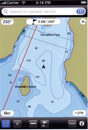
iNavX Marine Navigation is another popular marine app that runs on iPhones, iPads, and the iPod Touch. It is capable of all the necessary chartplotting functions — boat speed, course, heading, anchor alarms, track logging, etc. — and gives you the ability to import and export waypoints and routes. It also provides access to tide and current data and GRIB weather forecasts. It’s compatible with Navionics Gold charts and provides access to “thousands of compatible charts” from a large number of providers through the X-Traverse service (begins at $10 per year, depends on your operating system and the charts you select). This allows you to wirelessly transfer chart data from a PC to your smartphone and vice versa. One nice feature of this package is that it can display NMEA data via Wi-Fi from standalone AIS and other ship’s instruments. This one is also available at the App Store and costs $49.99.
While these devices are rapidly becoming an essential part of everyday life, they are not designed for use on board vessels at sea. First, as navigation devices, they are not full-featured chartplotters, lacking many of the features of conventional standalone chartplotters. Also, screen size and resolution are smaller, not able to show the detail of standalone plotters. Second, as emergency communication devices, the U.S. Coast Guard does not monitor these frequencies, their effective range is considerably less, and they are not very resistant to moisture, shock or vibration. So if you drop it in the bilge, it’s probably not going survive.
Finally, according to USCG’s Jorge Arroyo, the Coast Guard strongly discourages their use and has issued Marine Safety Advisory 01-10 which reads in part, “When mariners are navigating or working alone, the use of cellular or other devices unrelated to the operation at hand could . . . delay reaction time, or cause attention lapses which could result in circumstances having very serious consequences causing injuries and fatalities…”