Fog on the Maine coast is difficult to forecast accurately. If it descends mid-voyage you deal with it; fog that comes while still in harbor throws sailing plans into uncertainty.
Early summer this year was foggy and rainy, but by the time we left for our three-week cruise on our Sabre 30, Ora Kali, the weather was warm and clear. At the end of August we reached our furthest destination west at Tenants Harbor and were departing east for home on Frenchman Bay. The decision to do so was given urgency because I wanted to get Ora Kali out of Tenants Harbor ahead of a building southeasterly swell associated with Hurricane Franklin. The forecast also called for widespread rain and fog as waves of low pressure tracked through the Gulf of Maine starting around nightfall.
But the fog didn’t abide by the forecast. While we dinghied ashore for a last trip to the bakery it moved in from the south and played footsie for an hour, pulling away then settling in just as it seemed clear enough to leave. I grew increasingly impatient. Once the swell and bad weather arrived out of the east we would be stuck. I never like to leave on an ominous note, and having to get somewhere is when mistakes happen, but a skipper has to balance options and decide which to follow.
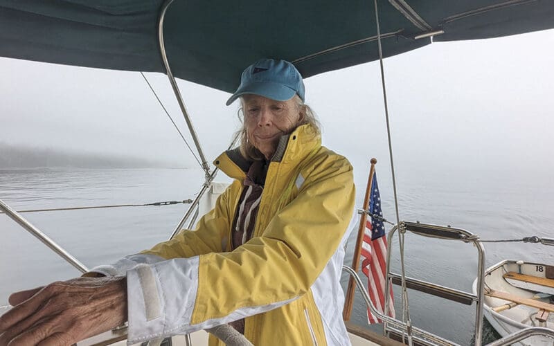
At 11:10 when the fog pulled back the sun shone out. The boats in the crowded harbor appeared like magic. I turned the engine on and my husband Tom dropped the mooring pendant in a light southeast wind that ideally should blow the remaining fog away.
As we threaded our way down the narrow harbor channel the remaining wisps of fog didn’t follow and we emerged into open water without incident. The ocean was calm and when the wind picked up Tom raised the main, I turned off the engine and we sailed.
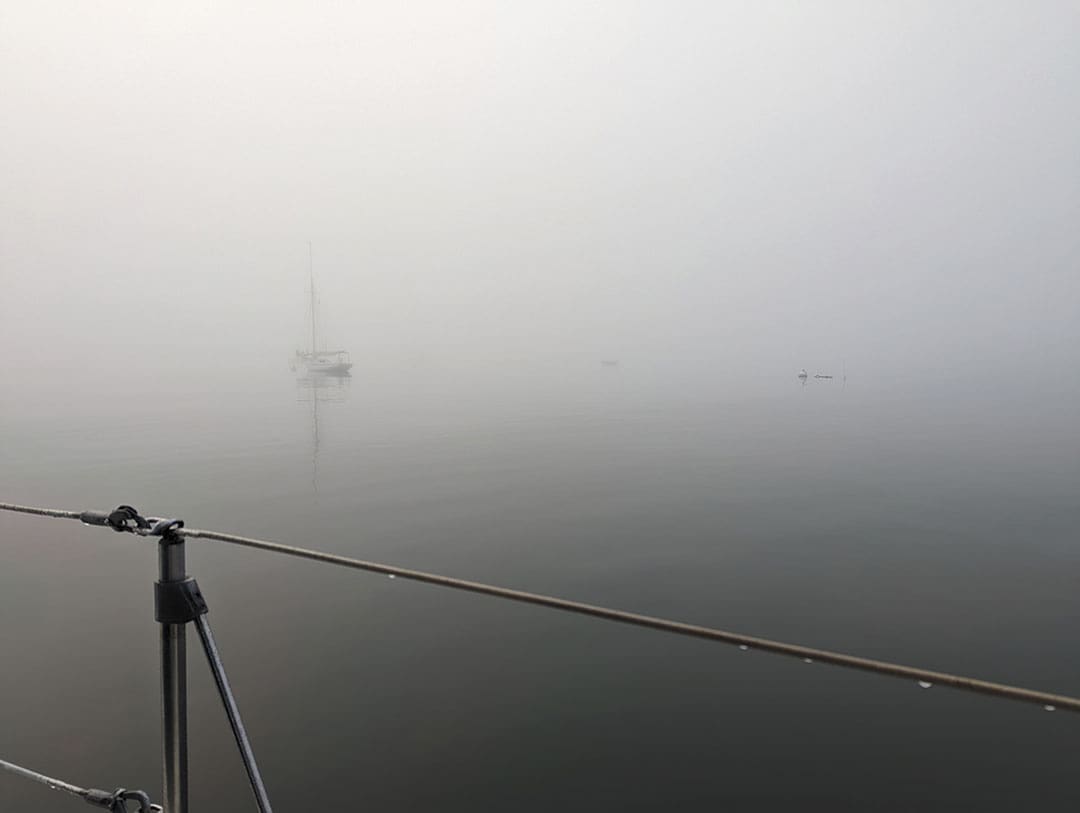
For 20 minutes we had good visibility; the sea stretching around us was empty of traffic. Then without warning the fog descended, turning the world around Ora Kali opaque though bright with the sun shining from above. I prefer to hand steer when coastal cruising and mostly use the Simrad GO7 XSR digital chart plotter at the helm for planning and as a backup to visual navigation but now I switched to navigating solely by the C-Maps chart image. With the track function turned on, Ora Kali’s track corresponded accurately with our exit course from Tenants Harbor, giving me confidence that I could navigate safely without the usual visual aids. Without engine noise we used our ears to listen for nearby boats.
Our goal for the day was Vinalhaven, the largest in a group known as the Fox Islands in the lower part of Penobscot Bay. To get to shelter we would travel northeast up West Penobscot Bay for about 11 miles. But first, we had to negotiate the mass of islands and shoals at the entrance to the bay itself.
In clear weather Muscle Ridge Channel would be our choice for this corner. It’s interesting in good light with favorable current, and without Franklin looming we would have anchored for the night inside at Dix Island. Two Bush Channel is more exposed and adds distance to the trip but it’s wide and easy to navigate, part of a series of passages that allows vessels to skirt the peninsulas that make up the Maine coast without crossing the Gulf of Maine.
We were still in open water when suddenly a loud growl came from starboard, and two lobster boats pounded past our stern. They’d seen us, I guess, though we hadn’t seen them until they were upon us. This made us nervous, especially since our speed under sail had dropped both because the wind was fluky and because the current was now strong in the approach to Two Bush Island. At just past noon we were at mid-ebb tide, which along the Maine coast flows west, and I turned the engine back on to motorsail.
Two days ago heading to Tenants Harbor we saw birds on the island but today with visibility down to less than a quarter mile we could only hear the lumpy seas crashing against Two Bush Reef. We crawled around it, bucking current. The mainsail now slatted uselessly and Tom took it down. Very quickly I got disoriented. I’m used to looking at the horizon to steer under power. Under sail there’s sail tension to steer by. The confused wave pattern didn’t help. Without any of these guides, if I took my attention away from the pedestal compass I veered off course and lost my sense of which way to steer to get back. It was unnerving, especially as over the sound of Ora Kali’s engine we could now hear several lobster boats tending their pots in our area.
No place along the course offered shelter to wait out the fog and for a few moments I regretted leaving Tenants Harbor.
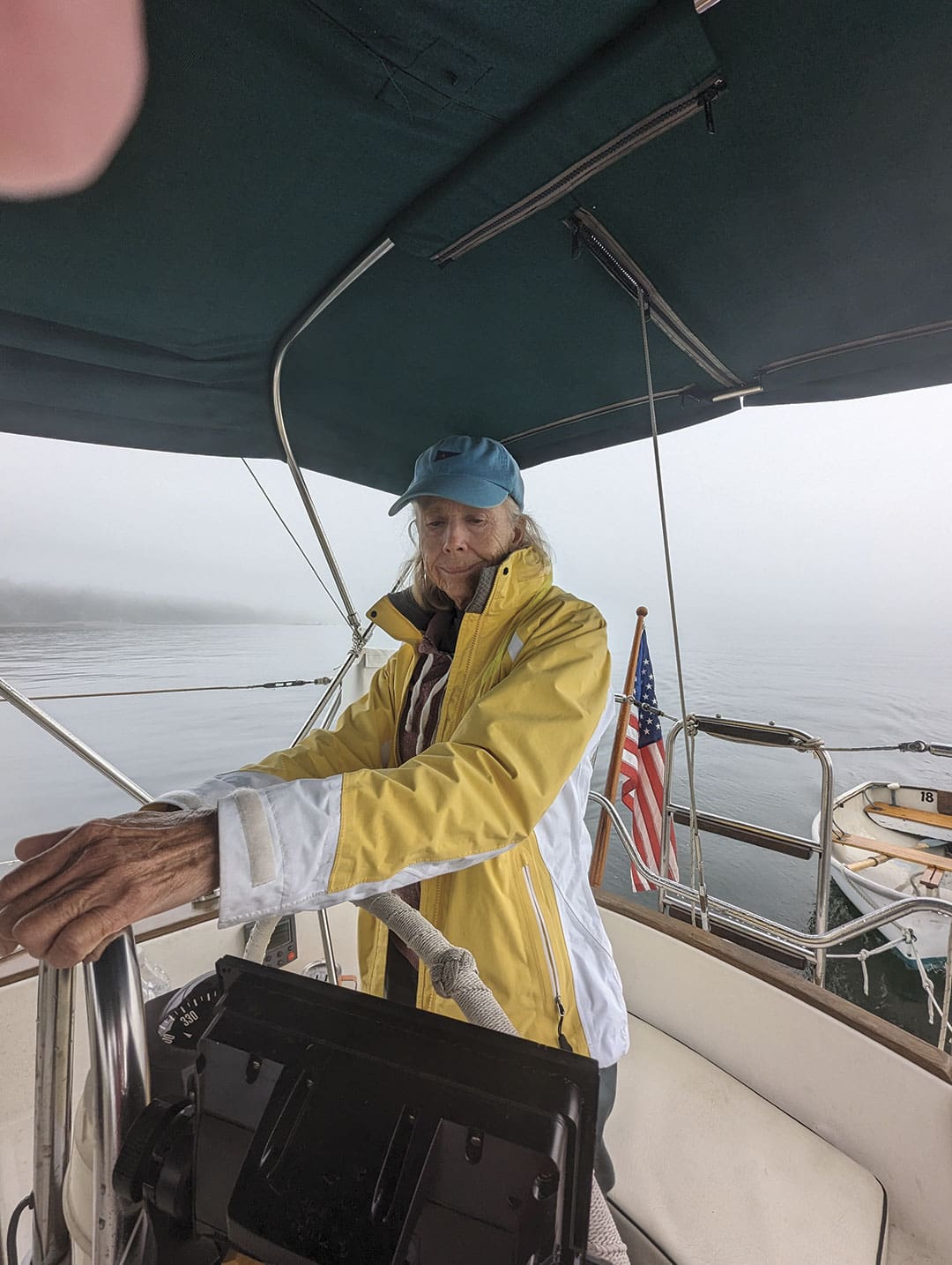
I did, however, have tools available to both make sense of what was around Ora Kali and keep a steady course. They were on the chart plotter but I needed to be able to look. We have an Autohelm Wheelpilot with a faded control panel on the cockpit coaming. I put Ora Kali on an approximate course and pushed the button to start it steering. This is a bit dicey in close quarters because of the lag between the course I want and the course the Autohelm unit picks. But with the autopilot functioning, a wave of relief passed over me. Suddenly I could gaze out at the foggy surroundings, bring my focus back to the chart plotter and read what it was telling me, all without Ora Kali going wildly off course.
We cleared Two Bush Channel and headed north into West Penobscot Bay, leaving the lobster boats behind and still fighting the ebb current. Less than a half-mile to port was a series of unmarked ledges where we might have heard the sea crash if we weren’t motoring.
Among other things, the chart plotter shows radar return on the digital chart. Regrettably, during our recent coastal passages I had mostly ignored our Simrad HALO20+ radar as we were blessed with fogless travels over the last two summers and I prefer to sail without the aid of instruments. Tom turned the radar on when the fog descended but it showed a mass of images that clearly couldn’t all be boats, and it wasn’t until I set the autopilot going and exited Two Bush Channel after missing the lobster boats that I made sense of the images it was showing. The last time we had radar we were bluewater cruising, and used it to track storms on the open sea or to find land. Now as we headed up the bay in open water I had the leisure to contemplate the myriad images and sort out the confusion. Most of the images were fleeting but a few were steady. The steady ones, I realized, had to be boats.
Our Standard Horizon VHF radio was also transmitting AIS information to the chart plotter, where it showed up as boat icons that corresponded pretty closely to the steady radar images, confirming what were most likely other vessels.
One of the steady images approached to port. The radar image allowed me to adjust course using the autopilot controls to keep Ora Kali parallel, and a white ketch appeared as a dim outline in the murk off our beam and also on AIS. We have an AIS receiver but don’t transmit, so the ketch must have seen us on radar.
Now, instead of traveling blindly, I had a bird’s-eye view of Ora Kali’s track that I could adjust to avoid potential collisions. Possibly there were boats in the murk that radar and AIS didn’t pick up, but we assumed the solid fog would discourage most small-boat traffic and we both kept lookout.
All went well until Tom saw lobster floats ahead. At first just one or two, then whole lines of them, looking huge and deceptively close in the murk. This is one reason I don’t use the autopilot in Maine waters. Few things are worse than to catch a pot line around the prop. I generally make small adjustments to the autopilot course to avoid over-correcting but pushing the + or – 1 button repeatedly does not alter course quickly enough to avoid the floats in the fog. I discovered that using the + or – 10 buttons I could initiate successful dodges and the autopilot allowed me to easily return to my original course in time to dodge the next one.
It was exhausting work that gave me a headache as we proceeded up West Penobscot Bay in a slow waltz. Three hours later on the approach to Fox Island Thorofare the wind picked up enough to motorsail. The fog finally dissipated, the Camden Hills emerged on the mainland in the distance, and an hour later, we were safely at anchor.
Would I make the decision to leave port on another foggy morning? It would depend on the weather forecast, my familiarity with the area, and how crowded it was likely to be with other traffic. Franklin’s swell did indeed arrive that night, and friends going west who hesitated got stuck in Tenants Harbor for several more days. n
Contributing editor Ann Hoffner and husband Tom Bailey cruised aboard their Peterson 44, Oddly Enough. She’s now based in Sorrento, Maine.