Tropical storm Ana, the first named storm of the season, developed early and directly in the path of our Nordhavn 52 trawler Dirona during a May North Atlantic crossing from Dublin via the Azores to Charleston, South Carolina. This was our third Atlantic crossing while voyaging around the world and, knowing that the North Atlantic can be difficult, we had plotted a route for the best weather and were comfortably ahead of the hurricane season. Yet a named storm was lying in wait as we proceeded.
Route planning
In determining the route for our spring passage from Ireland to the US east coast, we had a number of choices. The naive option was a 2,800-nautical mile crossing directly from Ireland to the eastern US, running fairly far south off Newfoundland to avoid the icebergs. But a near-steady procession of intense low-pressure systems flows from the US east coast towards Ireland and Scotland that time of year. We’d crossed the Atlantic along that route four years earlier, also in May, and had first-hand experience of what those systems are like.
That eastbound crossing, directly from Newport, RI to Kinsale, Ireland, was by far the most difficult we have made, with three gales and two separate mechanical issues to deal with. On most of our passages up to that one, we’d generally seen good weather with winds usually less than 20 knots and only rarely above 30. But most of these have been equatorial and timed for the statistically best time of year when storms are least common. Higher-latitude crossings are just more likely to encounter storms, even at the best time of year, and we’d crossed a month or two early, in May, to have more time to cruise the west coasts of Ireland and Scotland that summer. On that crossing we were running with the wind and waves. We’d have been running against them if we reversed that route, so we had even more reason to avoid those North Atlantic systems.
A second option was to proceed 1,300 nautical miles south to the Azores, a Portuguese holding 750 nautical miles west of Lisbon, and then head west to Bermuda en route to Charleston. The most direct route from the Azores to the US is an 1,800-nautical mile great circle route to Bermuda, then a 600-mile run to the US. The problem with that routing is the winds predominantly blow from the west, on the bow, making for a less comfortable crossing. And those storm systems that regularly move northeast across the Atlantic from the US east coast to Europe are big enough that many would still heavily impact us on that course.
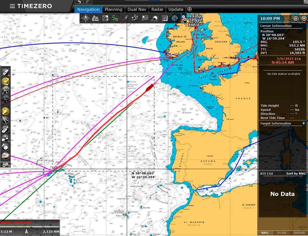
We chose a third option of traveling the 1,300 nautical miles from Dublin to the Azores and, instead of taking the great circle route to Bermuda, plotting a much more southerly course of roughly 2,700 nautical miles through the Azores High (also called the Bermuda High). The Azores High is a large semi-permanent high-pressure system in the Atlantic typically situated between the Azores and the Caribbean. This routing would add several hundred miles to the trip, so we’d be at sea longer and without the break of stopping in Bermuda, but the high probability of better weather attracted us.
Weather routing
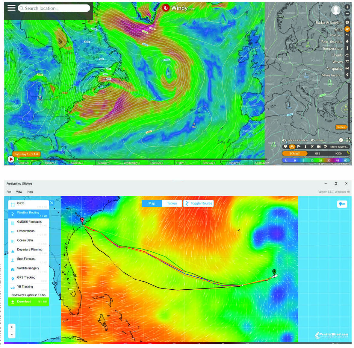
As always, we chose not to use weather routers and rather depend upon our own analysis of weather models and reports. For weather forecasting and routing on this trip, we used a combination of the PredictWind and the NOAA WW3 weather model available through our PC chartplotter software TimeZero. We leaned most heavily on the ECMWF model in PredictWind, but we watched for anomalies and outliers in all the available models.
In previous tests, we thought PredictWind was useful, but brought little new data to the table that we didn’t already have access to. We’re not sure if the application had improved greatly, or we just didn’t dive deeply enough into the features and options on the previous investigation, but we found PredictWind’s contribution to our weather routing decisions on this trip instrumental. PredictWind produces data for a variety of weather models in both graphical form and in a table form that can be easily copied into a spreadsheet. We can then use that data to analyze and compare conditions across the routes. Once we’d decided on a route, we could easily import it into our TimeZero chartplotter for the autopilot to follow automatically in navigation mode. Through both legs of this trip, we studied the weather models daily and downloaded a new route based on the expected conditions.
To generate our route from Horta to Charleston, we needed to create several waypoints to force the route through the Azores High, otherwise PredictWind would have routed us north of the high. We did enter power boat polars but, at the time, PredictWind didn’t take into account fuel economy with respect to weather conditions. We often find we can achieve better fuel economy on slightly longer routes with less weather.
Fuel, option value, speed, and safety
The Nordhavn 52 has many strengths, but speed is not one of them. The boat has a top speed of 9.5 knots and a passage-making speed of 6.5 to 8.0 knots depending upon conditions and available fuel. Major weather systems typically move at 8.5 to 13 knots, and sometimes even faster, so attempting to outrun storms has never been our favored tactic.
We may not be able to reliably outrun weather but we can divert course to avoid the worst of it. Doing so, however, could add hundreds of miles to a route and requires sufficient fuel reserves to support the increased travel distance. The option of making major course changes like this is one of several reasons we always bring deck fuel on longer passages. Another reason we often elect to bring deck fuel is to make passages longer than the 2,500 nautical miles our main fuel tanks can support with comfortable reserves.
Dirona carries 1,750 gallons of diesel for the main engine: 835 gallons in each side tank and 65 gallons in the day tank, plus a 15-gallon supply tank for the auxiliary engine. The aggregate fuel load, with a 10 percent reserve and conservative assumptions on wind and weather, supports a range of 2,500 nautical miles. We could achieve greater range by slowing down, but that increases our risk by keeping us at sea longer and giving us fewer options on course changes. Instead, fuel bladders make good sense for long trips in small boats. It’s a way of getting more range (which might only be needed a handful of times during the ownership of the boat) without giving up very large amounts of interior storage, living, and mechanical spaces.
It’s very difficult to have too much fuel or excessive range. As the common quote from aviation goes, the only time a pilot has too much fuel is when the plane is on fire. Large fuel reserves deliver option value. If weather conditions change or other reasons favor changing destinations, having more fuel on board might allow the change. Fuel also allows more speed. For a given trip, more fuel allows more speed up to the maximum speed of the boat. For very long runs, a small amount more fuel can greatly shorten the trip. We generally believe that shorter trips are safer trips and less time at sea reduces the likelihood of unpredicted unsafe weather conditions.
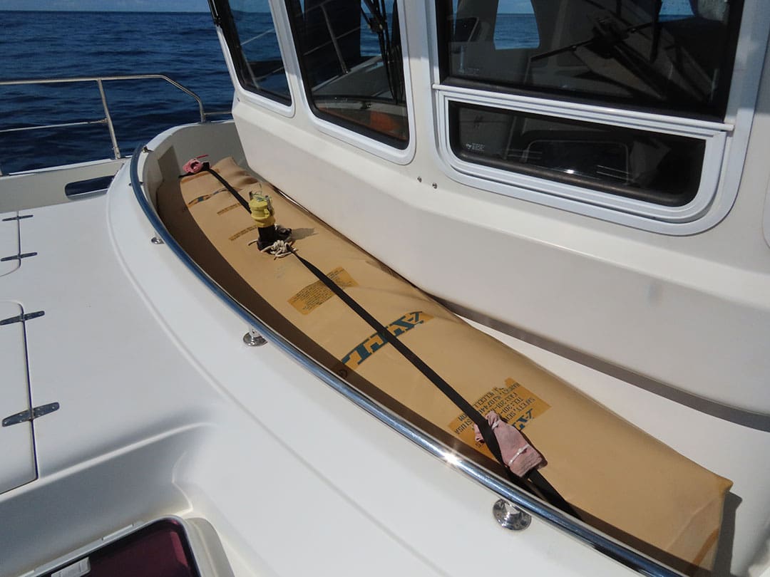
For our deck fuel, we use ATL Fuel Bladders. We picked ATL because they have a good reputation in marine, aviation and military applications, and from his car-racing days, James knew they could smack a wall at 200 MPH usually without catching fire. We initially purchased two standard 300-gallon bladders for the cockpit and later had a custom 360-gallon bladder built for our Portuguese bridge.
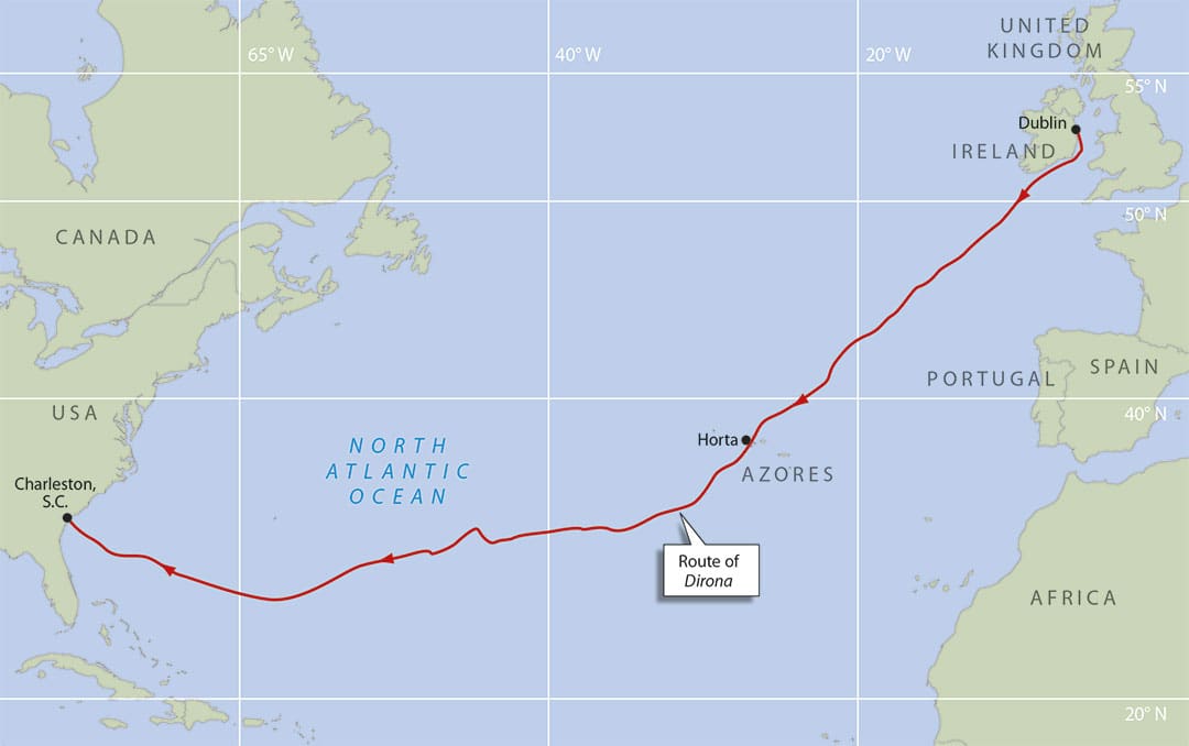
Dublin to Horta
In late April, we departed Dublin on a 1,330 nautical mile, eight-day run to Horta in the Azores. We fueled that morning, filling our main tanks and the three fuel bladders, for a total fuel load of 2,695 gallons. For the 1,330-nautical mile trip to the Azores, we didn’t even need the fuel we had below decks, much less to fill the bladders. But the second leg in our trip would be 2,700 nautical miles directly to the US east coast, and we’d need the extra fuel for that. The reason why we carried such a large volume of fuel on this first short leg is that fuel is twice as expensive in Horta as we were able to get in Dublin. Cost savings is another advantage of carrying fuel bladders. For example, on a single trip from Cape Town to Barbados via St. Helena, by filling all the bladders in Cape Town and taking on less fuel in St. Helena, we saved enough money to fully pay for the bladders.
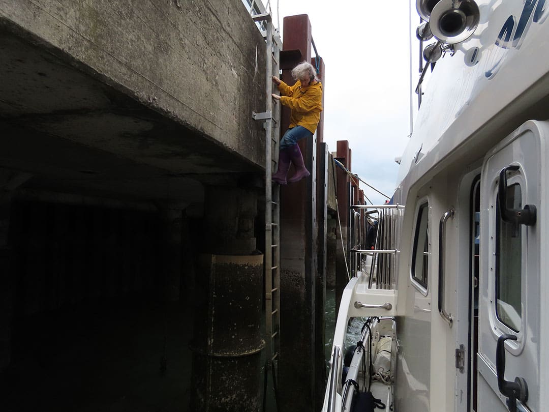
The winds were blowing a steady 25 to 30 knots in Dublin that first morning, generating a heavy surge at the commercial dock where we were fueling, and the seas were rough as we ran south off the Irish east coast. But conditions settled within a day and we had reasonably calm conditions most of the way to Horta in the Azores.
We did briefly pass through the leading edge of one of those intense low-pressure systems heading to Ireland from the US east coast. The waves weren’t very big, but were tight and right on the bow and we were pitching up to 14 degrees. This isn’t at all dangerous, but we did have to use care moving about the boat.
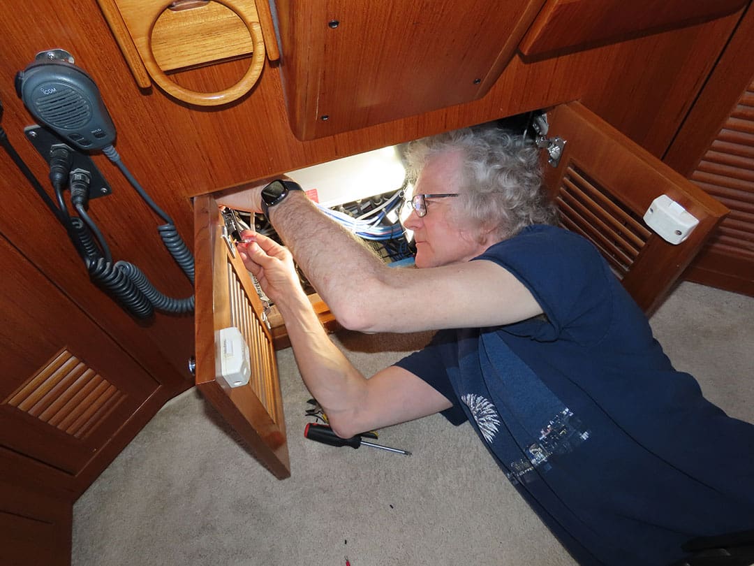
During this leg, we found and fixed an issue with our generator’s auto-start circuit. We normally run all draws off the main engine when underway and never run the generator at sea. But we do exercise all of our engines every three weeks and the generator didn’t automatically start when its test was due. We don’t like to arrive in port with maintenance debt, so we chased down the issue to a faulty ground wire in the generator start signal circuit. Installing a new ground wire got the system back to fully operational.
We also debugged a fault in the NMEA 2000 bus when our SC30 satellite compass lost heading. Using a Maretron N2kMeter to show bus errors, we isolated the problem to one of the five or 10 devices near the stern. Rebooting those devices, by disconnecting and reconnecting them from the NMEA2000 bus, resolved the issue.
Horta to Charleston
We initially had planned to spend three nights in Horta, but a passing weather system cleared faster than expected, so with our fuel load replenished, we departed after only two nights. The first week on our passage to Charleston was through wonderfully calm conditions in the Azores High, well south of several low-pressure systems moving across the Atlantic north of Bermuda. During this time, we crossed 12,000 hours on our ultra-reliable John Deere 6068AFM75 main engine; passed through the Sargasso Sea, the only sea without a land boundary; and consumed the full 360 gallons from our forward deck bladder.
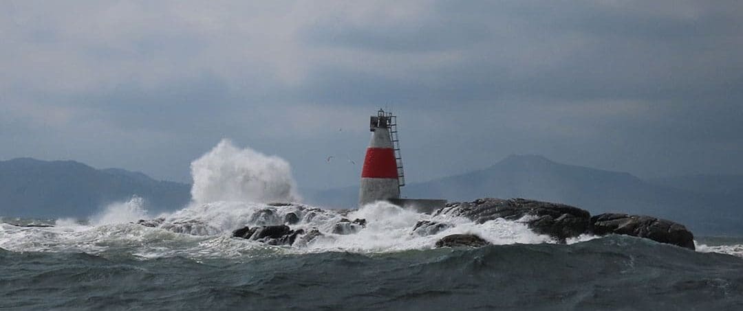
North of us, a steady stream of low-pressure systems headed east across the Atlantic from the US east coast to Ireland and Scotland. We were well south, but even protected by that substantial distance and the high-pressure area that we were operating within, one of the bigger storms was on track to impact us. We routed south 100 miles to minimize the worst of the system, but weren’t able to avoid it entirely.
As we passed through the southern tip of that weather system, the winds were steady in the high 30s with a peak of 43 knots. The seas were 12 to 14 feet, with some as high as 20 feet, with a ridiculously short period of seven seconds. They weren’t the roughest conditions we’ve seen, but they were up there, probably in the top five. This wasn’t convenient but, as long as were careful moving around in the boat, it wasn’t a problem. Had we been on one of the more northerly courses, the conditions would likely have been amongst the worst we’ve encountered in our travels.
Tropical Storm Ana
Little did we know at the time of setting off from Horta that, even with all of the course adjustments we’d made to minimize our weather risk and choosing a passage time outside of tropical storm season, we were actually heading directly into the first named storm of the year.
Shortly after passing through that first weather system, we were nine days out of Charleston when tropical storm Ana developed in our path. The Atlantic tropical storm season is officially from June 1 to November 30, with most storms occurring from mid-August to mid-October. Named storms do occur outside this range, and we were unlucky to encounter one in mid-May.
When tropical storm Ana first showed up in the weather models, we were about 1,500 miles away from Charleston and had just transferred the last of our deck fuel down to the main tanks, so they were nearly full. Having lots of available fuel allowed us to make some fairly substantial weather-routing changes that kept us in safer conditions.
This system was a little unusual in that it was moving from east to west and would absorb a smaller system off the Florida coast before heading in a more common northeasterly direction. Two systems joining together like that can be quite unpredictable, both in strength and direction. The storm also was expected to bring 25-foot seas, much worse than we’d ever encountered previously. This gave us two reasons to get as far away from the system as possible. We decided to divert a long way further south to avoid it, and added an additional 200 nautical miles to our trip.
We frequently monitored the weather reports over the next two days as the system continued to build to our north. In contrast to our previous diversion, this larger one was more successful, and we had only minor wave development and a corresponding loss of speed to contend with as Ana passed well to our north.
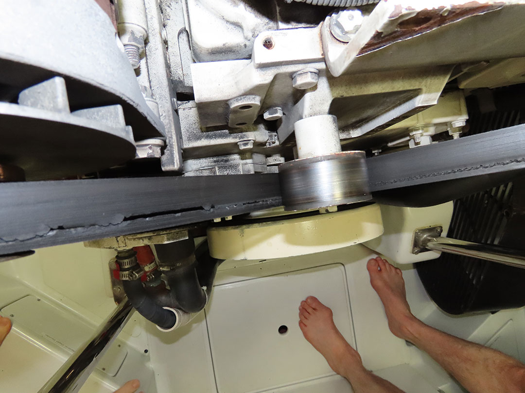
With the storms behind us, the last week at sea was enjoyable and uneventful from a weather perspective, but we did discover a problem with our main engine accessory drive belt. This required stopping the main engine and running on the wing engine briefly to replace the drive belt. It would have been easy to just hope that the belt could hang on until we reached Charleston, but it’s a good thing we did check, because the belt was in astoundingly poor shape. If the belt broke, coolant stops flowing and the engine would quickly overheat. With no coolant flowing hot spots can develop in the cylinder head so quickly that damage can be done even before the engine alarms.
We completed the final leg of our passage from Horta to Charleston in the same conditions as we started, with light winds, calm seas and great speed. We reached Charleston safely after diverting nearly 300 miles to minimize the impact from two major storm systems. This trip underlines the value of having ample fuel reserves on board to both make a passage longer than our on-board fuel can reasonably support, and to be able to make substantial diversions. Great weather data and routing from PredictWind and substantial fuel reserves delivered a safe crossing in unusually poor weather conditions. n
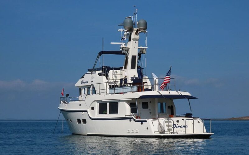
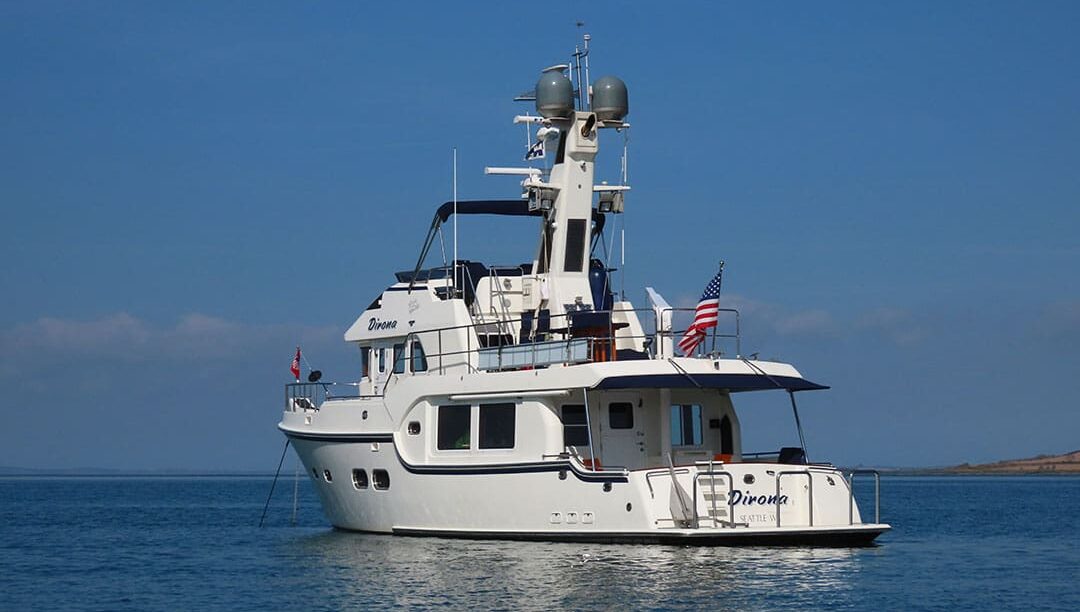
James and Jennifer Hamilton traveled around the world in their Nordhavn 52 trawler Dirona, across the Pacific, Indian and Southern Atlantic Oceans and twice across the Northern Atlantic, with themselves and their cat Spitfire as only crew. They particularly enjoy higher-latitude cruising and spent much time in southern New Zealand, Tasmania, Alaska, and Scandinavia. They are the authors of Waggoner Cruising Guide’s Cruising the Secret Coast and dozens of magazine articles, and document their travels in detail at mvdirona.com and youtube.com/user/mvdirona.