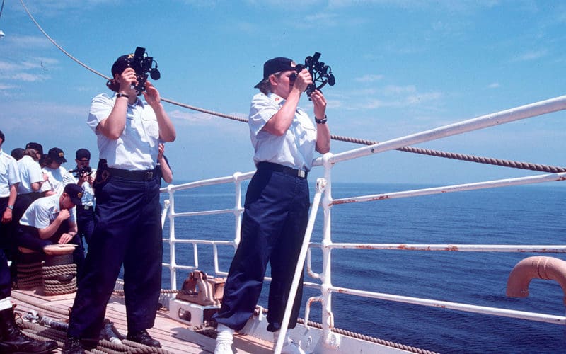
 On June 26, 2017, Eagle was sailing, en route to Prince Edward Island in the Cabot Straight, to the northeast of Cape Breton Island, Canada. Winds were light and variable and we were proceeding slowly to the west.
At 08:04 (UTC) I observed the sun rising with the upper limb approximately one-third of a finger’s width above the horizon. At 24:00 (UTC), I observed the sun setting with the upper limb approximately one-third of a finger’s width above the horizon. Adding the times of sunrise and sunset, and dividing by two, yielded a time of 16:02 – the “observed” time of LAN. As per the Nautical Almanac (or the mnemonics described in the main article), the equation of time yielded a predicted time for LAN of 12:03. Converting time to arc (one hour of time equals 15 degrees of longitude and one minute of time equals 15 minutes of longitude) yields an offset of 60 degrees 15’ from the Greenwich Meridian — i.e., a longitude of 060 degrees 15’ W.
I also observed Polaris shortly after sunset. Using my hand, and multiple observations, I measured it to be approximately four vertical fists (@ 10 degrees) + three finger widths (@ 2 degrees) = 46 degrees above the horizon (i.e., latitude of 46 degrees N).
Thus, my manually calculated position was 46 o 00’ N, 060o 15’ W at sunset. The actual position, as per GPS, was 47o 07.1’ N, 060o 51.9’ W. My calculated latitude was off by approximately 1 degree 7 minutes and my calculated longitude was off by approximately 37 minutes. Plotting these positions revealed that my manual determination was accurate to within approximately 74 miles — very reassuring.
Note that the imprecision described above was also impacted by the fact that Eagle was moving (albeit not particularly fast). In particular, from the time that I observed sunrise, to the time that I observed Polaris, Eagle had sailed approximately 69 miles to the west (for an average speed of approximately 4 kts). If Eagle had not been moving, or moving only very slowly (similar to a life raft), then the error in our observed position would have been a bit lower or a bit higher (depending upon the exact speed).
Of note, I was able to achieve similar results on other days and on other passages. The bottom line is that these techniques work.
Steven Henkind