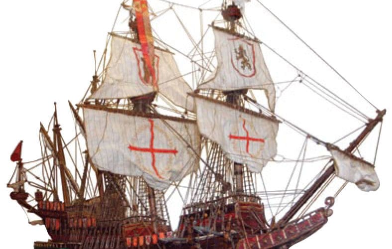
When the Spanish empire expanded in the mid-1500s to include New Spain (Mexico) and as far west as the Philippine archipelago, it ruled much of the world as a military and economic superpower. During this time, the Spanish opened up a trading relationship with China and countries in the East, shipping huge quantities of silver mined in South America in exchange for spices, porcelain, textiles, fruits, and vegetables. From 1565 to 1815, a profitable trade existed between New Spain and their outpost thousands of miles to the west in the Philippine archipelago. This trading system was known as the Manila Galleon route, named for the port of call in the Philippines and the type of ship used in the trade. Galleon were ships weighing up to 1,500 tons, with three or more decks and three or four masts with a lateen sail on the aftermost. They were stable and capacious — perfect for commerce.
This trade route was also sometimes referred to as La Nao de la China (the China ship) because the trade brought a predominance of Chinese goods from Manila to Acapulco.
A Spanish navigator and friar with the name Andres de Urdaneta cracked the mystery of how to make the long passage from Manila to Acapulco. The route he discovered, the Pacific wind gyre, assured that sailing ships would find favorable winds heading back to the east, though it will be said that even under the best conditions, the passage could take up to seven months. Before becoming a friar, de Urdaneta was a renowned Spanish explorer and navigator. He navigated the second circumnavigation after Magellan, which was no simple task, as in those days for position finding they were using an astrolabe and perhaps a kamal. De Urdaneta’s most important discovery was understanding that there was a Pacific Ocean wind gyre of the same type that existed in the North Atlantic.
He discovered where it was and how to exploit it so that ships could make the more than 8,000-mile passage back to the Philippines. This route was essential for sailing ships heading east, and it was known in honor of the friar and referred to as “Urdaneta’s Route.”
Let’s join the galleon Ray Fernando, one of the last to sail in 1815. We are at a DR of 14° 15’ N by 122° 10’ W on a westbound passage. The day is March 15, and we will be using the 2021 Nautical Almanac. For the sake of keeping our skill level sharp, we will be taking an afternoon sun line in order to find an estimated position.
The time of our lower limb observation is 23:15:20 seconds GMT. The height of eye is 20 feet. The sextant altitude Hs is 43° 17.4’. Find the Ho and then, using HO 249, find the intercept and plot the estimated position. n
A. What is the Ho?
B. What is the intercept?
C. What is Zn?
D. What is the estimated position (EP)?
Answers
A. Ho is 43° 28.3’
B. Intercept: 10.7 nm away
C. Zn is 255°
D. EP is 13° 58’ N by 122° 40’ W

