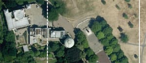
In 1884 the battle of the prime meridians ended. The International Meridian Conference in Washington, D.C., concluded with the majority of the 26 national delegations voting to make the meridian that passed through the Royal Observatory at Greenwich, England, the official prime meridian (the French, who had argued for the Paris meridian, abstained from the vote and even continued to use the Paris meridian for years).
Go to the Royal Observatory today and you can toe the stainless steel line set into the pavement that signifies the precise location of the meridian. Except now a group of five scientists have tarnished the Royal Observatory’s line a bit by releasing a study showing that the true prime meridian is actually 102 meters to the east! (“Why the Greenwich Meridian Moved,” Journal of Geodesy, August 2015). Will this finding ignite an international prime meridian dust-up and eliminate the Royal Observatory’s special status?
Differences over prime meridians are not new. At one time, most seafaring nations had their own cherished prime meridian on which to base their nautical charts. The Portuguese, Spanish, French and the British each had one. The U.S., with its British antecedents, generally deferred to the Greenwich meridian — there was never a great patriotic movement to put the U.S. prime meridian through the parlor at Mt. Vernon or Betsy Ross’ sewing room in Philadelphia.
How could the prime meridian line, as definitely set by British Astronomer Royal Sir George Airy in 1850, be 102 meters (or 334.64 feet) off? The reason is that 19th-century astronomers like Airy weren’t able to measure the vertical with great precision. And unless you can do that, you can’t precisely measure the transit of astronomical bodies across the meridian and therefore precisely measure its position — hence the 102-meter error.
The instrument that astronomers use for measuring when celestial bodies cross their meridian of longitude is something called a transit circle telescope. These telescopes are mounted so they can only sight along their meridian of longitude. For a telescope in the Northern Hemisphere, that would be from 0° on the southern horizon to 90° directly overhead and then down to 0° on the northern horizon. To get as accurate a measurement as possible, however, the telescope has to be built so it is perfectly vertical at 90°. Celestial navigators know about this need to “establish the vertical” — that’s why they “swing the arc” to make sure they are taking their sights with the sextant as vertical as possible.
Astronomers like Airy knew it too. That’s why they did their best to establish the vertical using plumb bobs and mercury levels. Airy believed the transit circle telescope at the Royal Observatory was built properly. The technology of the day was limited, however, and we now know he and his colleagues were off by just a bit.
“You can’t say they did anything wrong,” said Ken Seidelmann, a research professor in the Astronomy Department at the University of Virginia and one of the authors of the new study. “They were doing the best they could.”
What Airy didn’t have was a measuring tool of sufficient accuracy to establish the vertical. Plumb bombs and mercury levels can’t do the job because the earth is not perfectly smooth and round. The globe is actually classified as an oblate spheroid: It’s flatter at the poles, and bulges at the equator. In addition, there is localized “lumpiness” — mountains and valleys. These aspects of the earth’s shape affect the local gravity field, which in turn affects what a plumb bob or level tells you about what is vertical. An analogy is how a magnetic compass on a boat can be affected by large pieces of metal like an engine. The result is that the astronomical approach of measuring the meridian is only so accurate.
A different way of measuring the vertical is needed and that method arrived with the development of the satellite.
Once satellites began regularly orbiting the earth, scientists realized that in addition to communications, weather observation and other uses, satellites could also obtain a detailed picture of the earth’s shape. As a spacecraft flies over the earth’s surface, it reacts to the localized gravity field below it — changing its orbit slightly as it flies over the bumps and valleys. By precisely tracking a satellite’s position throughout its orbit, a detailed picture of the earth’s shape emerges. Scientists use this detailed picture to construct a new geodetic model for the earth. And this geodetic model is used to create a new datum for making maps and charts that uses the center of the earth, not the surface of the earth, as it starting point. The satellite-derived, center-of-the-earth-based World Geodetic System 1984 (WGS 84) replaced surface-based local datums like the North American Datum 1927 (NAD 27). And GPS satellites using the center of the earth are able to determine the vertical at any point on the earth in a way that is unaffected by the earth’s oblate, lumpy shape.
When you combine the correct vertical with several other factors like datum differences, you get the 102-meter difference between the location of the prime meridian as determined by astronomical techniques and its position as determined by geodetic techniques. Even though the difference is 102 meters at Greenwich, because the lumpiness of the earth varies, the difference changes depending on your location.
The good news is that these small differences won’t mean that we have to redraw all our nautical charts. The prime meridian will still officially cleave the Royal Observatory in Greenwich just as it has since the Washington Conference of 1884.

