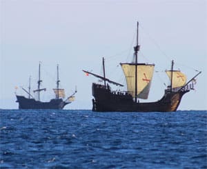
In its day — more than 500 years ago — the nao (ship) Santa Maria embodied a sailing design that was as modern then as the fastest-designed sailboats are today. The nao became Christopher Columbus’ flagship and the largest of the three ships used by him during his first westward passage.
Santa Maria had already established a reputation as a successful working vessel in the Baltic before Columbus asked that it be requisitioned by Queen Isabella. The original owner, Juan de la Cosa, was a well-known and experienced captain and navigator hired to be the captain of Santa Maria on Columbus’ voyage — though, often during the passage and contrary to tradition, Columbus superseded his authority. Ultimately, Santa Maria grounded in Haiti on Christmas Day in 1492 and was dismantled to build La Navidad, which was the first Spanish settlement in the New World.
Santa Maria was a medium-sized ship of the time, about 58 feet on deck with three masts. It was part of a class of ships called “carracks.” The stern and bow were rounded and had large after and fore castles built onto the ship. The carrack developed between the 14th and 15th centuries in Spain and Portugal. Originally designed for trade between the Mediterranean and Baltic Seas, they were square-rigged on the fore and main with a fore and aft lateen sail mounted on the mizzen. During its heyday, this was a successful sailing amalgam. It had a wide and deep keel, allowing it to carry bulk cargo. To modern eyes, these vessels seem dangerously slab-sided with a center of gravity way too high.
Despite all the sail area, ships like Santa Maria could only make an average of 4 knots. For the 40 men on the first passage to the New World, it probably seemed that the trip would never end.
At the time, celestial navigation was in an advanced state, at least theoretically, but the tools available were lacking. It would be at least another 300 years before the sextant was in common use. All the tools that Columbus would have used — like the astrolabe, quadrant and nocturnal — were gravity based, which creates many inaccuracies on a ship rolling around in the sea. He was mostly unsuccessful in all his efforts at celestial navigation but was an undisputed master of dead reckoning. He navigated three and a half times from the Old World to the New World successfully, just using speed, time and course. Pretty impressive!
The most accurate method of finding latitude was to use a nocturnal and Polaris. As long as a mariner is north of the equator and the Dipper is visible, latitude can be found. Let’s do a modified example of a Polaris observation. Since we don’t have a nocturnal, we’ll use a sextant sight to find latitude from Polaris. On Dec. 2, using the 2019 Nautical Almanac, we are at 23° 35’ N by 82° 15’ W off the north part of Cuba — just where Columbus was when he did a latitude observation of Polaris in December of 1492. We have a height of eye of 20 feet. Hs is 23° 34.6’ and the time is 2100 GMT. Find the Ho, and then find the latitude using the Polaris reduction tables in the back of the almanac.
A. What is the Ho?
B. What is the latitude?
Answers
A. Ho is 23° 28.1’
B. Latitude is 23° 35.3’

