Access to weather forecasts has improved tremendously in recent years. Getting weather data in Grib format via satellite has made the process of voyage planning and in-passage weather adjustments vastly easier than in years past. What if you could know the situation ahead on your course while you were voyaging? Turns out that in many ocean areas that is actually possible via deep water buoys that collect a slew of data, including images of the surrounding sea state. And now a company in Canada is offering a product that further increases buoy awareness.
There was a time when buoys were little more than floating numbered markers. Then lights were added to improve their usefulness at night. Solar panels provided a way to keep the batteries of lighted buoys charged. And as sensor packages moved toward smaller and less power-intensive digital units, weather instruments could be added to selected buoys.
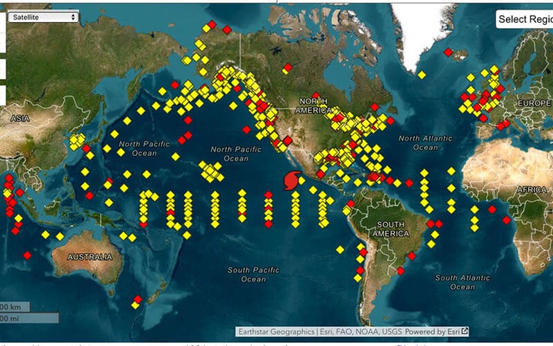
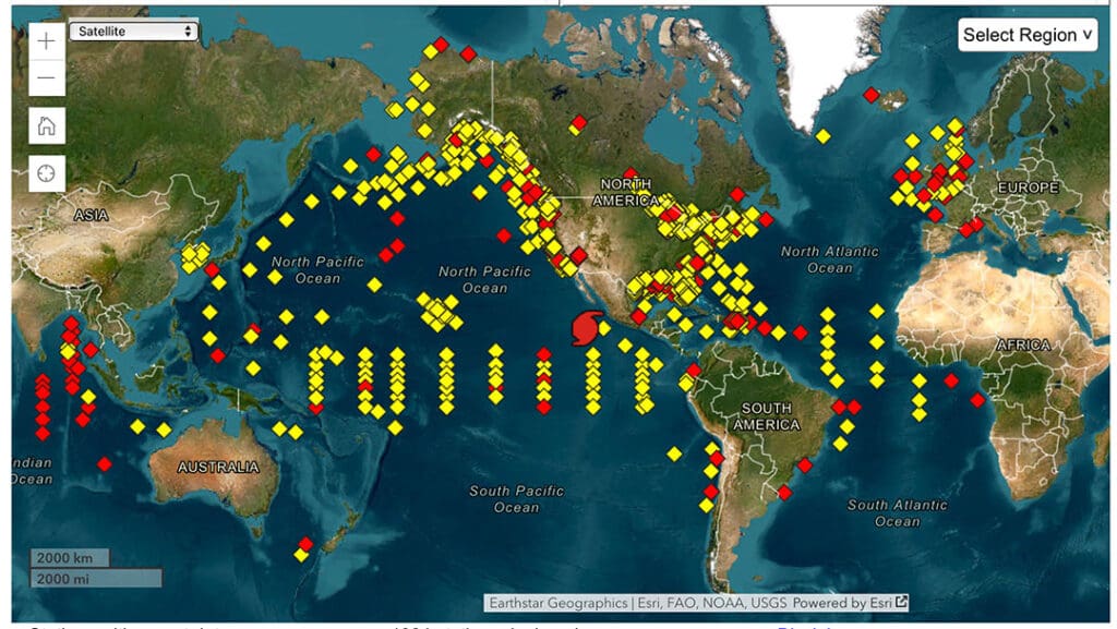
While no voyager would consider trying to anchor in the deep ocean, there are buoys anchored in places of great depth. These buoys, operated by NOAA’s National Data Buoy Center (NDBC), are loaded with instruments for gathering weather and wave data. These buoys provide weather data used by NWS for weather forecasts but the data is also made available to any mariner who wishes to access the data stream.
Let’s look at an example buoy. Station 41001 is three meter- (9.8 feet) wide discus buoy located 150 nautical miles east of Cape Hatteras at 34° 42’ 9” N 72° 14’ 31” W. This position is somewhat approximate, however, since the buoy’s moored at a depth of 4,501 meters (14,767 feet). These means that the buoy has a watch circle radius of 4,571 yards, or 2.25 nautical miles.
What types of data do buoys like station 41001 collect? Wind direction and speed, atmospheric pressure, dew point, heat index, wind gust, air temperature, water temperature, etc. With motion sensors on board it can collect a variety of wave data: significant wave height, swell height, swell period, swell direction, wind wave height, wind wave period, wind wave direction, wave steepness and average wave period. Station 41001 is also equipped with cameras that collect six low res images hourly of the scene around the buoy. All this data gets uploaded via satellite and is available on the NDBC website (www.ndbc.noaa.gov).
In addition to these offshore weather buoys, the NDBC is also responsible for other types of data stations. As Dr. William Burnett, Director of NDBC, explained in an email: “NDBC operates different offshore moored buoy networks. NDBC operates 104 ‘weather’ buoys that are located in deep-ocean and coastal waters around the United States, measuring wind speed, wind direction, atmospheric pressure, air temperature, relative humidity, sea surface temperature and wave height, period and direction. NDBC operates 55 ‘climate’ Tropical Atmosphere Ocean (TAO) buoys located in the equatorial Pacific Ocean that measure wind speed, wind direction, air temperature, relative humidity, air pressure, ocean temperatures and salinity with depth. Finally, NDBC operates 39 ‘tsunami’ Deep Ocean Assessment and Reporting of Tsunamis (DART) located around the Pacific and Atlantic that only measure deep ocean temperature and pressure that can detect tsunami waves.”
The data from these buoys is relayed to NOAA on shore via a mix of satellite systems. Dr. Burnett wrote, “NDBC’s marine observations are transmitted via the Department of Defense’s Iridium Router-based Unrestricted Digital Interworking Connectivity Solution (RUDICS) or Iridium Short Burst Data (SBD). For our coastal meteorological stations, we mostly use the National Oceanic and Atmospheric Administration (NOAA)’s Geostationary Operational Environmental Satellites (GOES) communication network.”
While there are a variety of commercial firms offering instrumented buoys for scientific work, like YSI, AXYS and others, some firms are also getting into the buoy view space as a complete product for subscribers. Private companies are also getting into the buoy view space. MarineLabs from Victoria, BC, has a product called BuoyCam. The company has placed data and image gathering packages aboard Canadian coastal navigation buoys. Subscribers to the BuoyCam service can access the data from a buoy via the internet and get weather and wave data and, like the NOAA buoys, can get images of local conditions collected by the buoy. As you’d expect, the data from BuoyCam is presented in a much more graphically pleasing manner than the US Government-based data from its buoys.
The next step in this trend of giving buoy sensors and cameras is likely the use of video in the place of still images. As satellite networks like Starlink and its competitors expand the options for moving data, putting video feeds on buoys could become as common as lights and bells. n