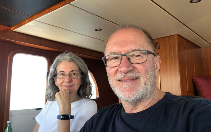
That if you had a life-long urge to explore the Pacific Ocean, following in the footsteps of a favorite explorer like Captain James Cook? Power voyager Peter Niederreiter has just such an inclination and he and wife Melitta recently voyaged from Mexico to the Marquesas aboard their Nordhavn 52, Fortuna Star. Let’s follow along on the first leg of their Pacific journey.
Peter had a career as an eye surgeon but always traveled the world, often accompanied by Melitta. They were so committed to travel that they both obtained pilot licenses and flew all over Europe. They were determined to carry out their transPacific dreams, initially considering a voyaging sailboat. While traveling in Minorca, however, Peter saw a trawler yacht at anchor in Mahon harbor. This led him to begin researching Nordhavn Yachts, including a visit to Nordhavn’s European headquarters in Southhampton, UK. The couple chartered several Nordhavns in Alaska and Canada and began to search for a Nordhavn that fit their requirements. They found the boat they were looking for in Seattle, their current Nordhavn 52, Fortuna Star. After a trip to Nordhavn headquarters in Dana Point, Calif. where Fortuna Star received some final additions, they departed from Mexico at the end of March.
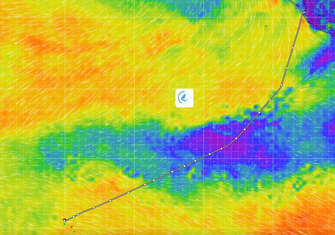
The following excerpts are from diary entries written by Peter. The Niederreiters used PredictWind software on their passage and Peter posted entries on the PredictWind website.
Sunday April 2: After three days at sea we get used to the gentle rolling of the waves. Life aboard is scheduled by routine chores and taking care of the vessel. We’ve reached the tropics — temperatures and humidity are rising. We have enough fuel to extend our great circle course somewhat southerly and try to catch the ITCZ calms as much as possible. On the last third of our trip, I am planning to speed up the boat and try to regain one day at sea. We are driving the boat at a fuel usage of a little less than three gallons an hour. The speed is dictated by the wind, waves and current. We expect to have some currents in our favor later on the trip.
Tuesday April 4: We are experiencing only light winds from behind, but confusing seas with waves up to 2.9 meters [eight feet]. The main swell comes from easterly directions caused mainly by the Papagallo winds off the coast of Central America. The secondary swell comes from the NW. The mean height of the waves is perhaps 1.5 meters [five feet], but the combination of the two components can add to reach a significant level.
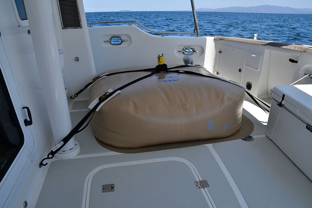
Thursday April 6: The weather routing is fitting our expectations, the seas got a lot better and the winds are light. Perfect conditions for the fuel transfer task. In our cockpit we carry a fuel bladder with 300 gallons (about 1,100 liters) of diesel. After burning enough fuel on our starboard tank, we completed the transfer in a two-hour project. Thanks to Jerry Brackley in Dana Point, who conceived the transfer pump in a Pelican case. The pumping itself took only 25 minutes to complete. Cleaning up and folding the bladder was the major job. Now all is stored, the range is up to 3,500 nautical miles on our Maretron display again. As expected, we joined a current in our favor, giving us up to eight knots of speed with an unchanged fuel flow of 2.8 gallons an hour.
Saturday April 8: This past day has been, compared to the previous ones, very different. It was overcast with some gusty winds of changing direction. As the evening approached the first thunderstorms encircled us. This is what you expect, approaching the equatorial calms with a flat pressure gradient, high humidity and temperatures. Our two doppler radars were on heavy duty, providing enough information to the captain to dodge through, also avoiding dangerous lightning. As a precaution we put our laptop, iPad, handheld communication systems and phones in special radiation blocking bags and put them in the oven for protection. The evasive measures were necessary all night. With the sun rising, we should reach a calmer zone with clouds and some rain, but hopefully no drama. After 25 years flying as private pilots, we thankfully have experience in the interpretation of weather phenomena. With information from 500mb charts, precision barographs and data provided by our satellite service, we are confident to find our way.
Sunday April 9: After a day with thunderstorms, we entered the zone of calms. Cumulus clouds and big, smooth rolling swells. The boat seems to ride an elevator up and down, our perspective changing each time. At the end of the day our latitude had dropped to less than three degrees north. The equator crossing is approaching — we then will join the Southern Hemisphere and glide towards the South Pacific Islands. In the evening we change our course to a more westerly direction. We adopt small changes every 24 hours and a little more when the weather routing allows.
Monday April 10: Getting an Iridium connection near the equator is almost impossible. For 48 hours we did not get any weather updates. Based upon what we got, we decided to make the final main course correction and are now heading on a great circle course direct to Nuku Hiva. Within the next few hours we will also reach our halfway point.
A word about water making. We have a fresh water tank of 430 gallons (1,500 Liters). We are doing all our fresh water with our FCI MaxQ water maker from sea water. Although the system checks the water quality by itself, we also manually check the result at the water tap with a portable water checker. Moreover, all our water is purified by an UV-lamp before it is distributed to the outlets. Usually we will refill our tank every two or three days, as soon as the water level drops to around 65%. Within three hours we are full again.
Tuesday April 11: The satellite communication issue is resolved. Due to our course direction, the position of the antenna on the stack and the fact that the Iridium satellites are circumpolar the signal was shaded for most of the satellite passages. It was only usable for short periods. Using a second portable antenna and positioning it with a better sky view, the transmission is strong and fast.
Wednesday April 12: At 17:34 local time (00:34 UTC) we slipped down to the other side, crossing the Equator for the first time on the ocean and in our own ship. For 36 hours a current against has been slowing us down. The equatorial swirls of an ENSO transition, from La Niña to El Niño are producing the current, although adverse currents are always expected here. This should change in about 100 miles. Then, we should get a nice push, compensating for the delay. The pilot books for the Pacific crossing, that compute data for each month of the year and relate to statistics, starting from 1850 up to now, show a fantastic correlation. I used the information for planning the route and so far the temperature (air and sea), currents, clouds, rain, winds, are as shown on the prognosis.
Thursday April 13: The current against us is stronger and lasts longer than expected! Speed though the water is a constant 6.4 knots and only 4.5 to 5.1 over ground! There is always a compromise to make — either stronger winds or stronger current. We hope that the current will soon die down. The swell has now an interesting pattern and is a combination of waves coming from the NE and NW forming an X-pattern and causing the boat to have sudden movements. This makes the stabilizers work hard.
Sunday April 16: Since my youth, I became an admirer of the numerous achievements and knowledge of Captain James Cook. I learned that he brought charting to perfection. He learned to take methods used by land surveyors and adapt them for use at sea. He did this while in Halifax, Canada in his early twenties. Buying our Nordhavn through the Europe office in Southampton, led to having a British Flag on our boat. The yacht was built for the American market and had no EU Certification. The British Registry was the solution. Without much planning, I now cross the waters under a flag that represents my great teacher and an iconic figure of history.
Tuesday April 18: Overcast skies accompany us, as we get closer and closer to our destination. Less than 450 miles remain to be navigated. Every now and then a rain squall passes us, the wind gusts up, the waves get bigger and then all returns to a less turbulent state.
Wednesday April 19: Less than 300 miles to go. The countdown has begun! In this region it is the rainy season. We are constantly surrounded by rain cells and every five to six hours get our boat thoroughly washed. The winds are changing from three knots to 17 to 18 knots before it rains. The seas are quite high and the wave period drops sometimes to an uncomfortable six seconds. Since the waves come from the aft port side quarter, the boat rolls accordingly with roll angles up to 10° or more.
Thursday April 20: At sunrise, 5:54 Marquesas time (14:24 UTC) the island Ua-Huka came into sight. The haze is dissipating and I can see the mountains. We are 34 miles out of the passage between Ua-Huka and Nuku-Hiva. We will now have breakfast and watch the island get bigger and clearer.
Friday April 21: The arrival in Baie du Taiohe is surreal. The light and the setting could have been taken out of a Hollywood blockbuster movie. On the one side the mountain is lit by the sun, on the other hang clouds as if a blanket is thrown on top. Different greens and shades of grey are complemented by some intense scents of vegetation, all new to our passage-neutralized noses. After dropping the anchor among 38 other boats, all sailboats, we settle in and have a drink. n