
Certain harbors are gathering places for sailors headed offshore. Back in the good old days I met a lot of fellow cruisers while arguing about the weather as we holed up waiting for a weather window to jump offshore. The sources of information were few — pretty much everyone shared the same data. Here in the USA the main sources were NOAA Coastal, Offshore, and High Seas text forecasts, gathered by weather fax, VHF and SSB radio. Sometimes we downloaded small-scale (large area) weather maps that gave us very general information on huge areas of ocean. And sometimes we just walked up to the weather station, as in Bermuda.
Offshore, many of us didn’t get further updates, except possibly some scratchy voice forecasts via SSB radio. We usually sailed with three or four days of good predicted weather, after which we took what we got. Forget trying to predict the weather in segments smaller than 100 miles. Ocean current predictions were just general averages.
There were a lot of little things we did to supplement forecasts. We would wait in harbor until the wind clocked around after a front. A thermometer would tell when we had reached the Gulf Stream. A change in swell patterns might tell of an approaching storm. A certain ocean color and a type of seaweed indicated you were in the Gulf Stream. Or, you could spot the stream miles off by the line of clouds and thunderstorms down the middle.
Sounds pretty primitive, but all of these seat-of-the-pants methods, in conjunction with historical weather and route information summarized on the pilot charts, worked quite well. Still, I would argue that choosing the right route in the right season remains the single best weather decision you can make.
Taking into consideration not only the wind, but the currents, the speed of your boat, your planned times of departure and arrival, can be confusing. Wouldn’t it be nice to read a general forecast for a large ocean segment, hundreds of miles on a side, and a weather map with winds and currents for that patch? What if you could take into account other variables and automatically get a plan for best departure and arrival times, along with the route to take for the most comfortable passage?
There’s an app for that
The digital revolution has brought us an era where we not only have 10 to 14 days of coastal weather predictions served to us via the internet. Many voyagers continue to enjoy these benefits when offshore by utilizing weather apps, satellite internet connections, and high-resolution displays, from phones, laptops, dedicated chart plotters and large monitors. Resolution is such that you can download predictions for your patch of ocean, including ocean currents. The addition of near-real time ocean current information is a huge leap forward, and makes for a much speedier and more comfortable trip.
It is beyond the scope of this article to get into how to download or view these digital products when offshore. Voyagers I have contacted are well connected using cellphone services when near shore, with products like Iridium GO! for voice and text, and now Starlink for full internet while offshore. Even cell phone apps can be used onboard if you can supply a wifi router with internet via satellite.
FastSeas
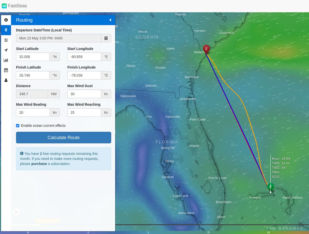
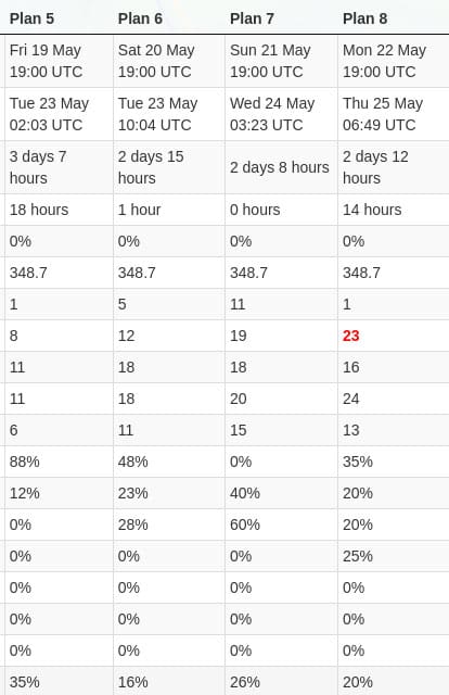
For example, FastSeas.com is an online weather routing tool that allows you to input your preferred departure point, destination, boat speed, and other factors, and then provides 15 different downloadable departure plans based on predicted weather, including ocean currents.
When running a possible route from Savannah to the Bahamas, which requires some tricky routing to cross the Gulf Stream and various eddies, it was interesting to see how delaying departure a day or two could result in a savings of 24 hours on a trip of only around 350 nautical miles!
You can export route positions to KMZ, KML, GPX or CSV files for adding to other chart plotting systems. Sherry McCampbell, cruising in Southeast Asia on her catamaran Soggy Paws, said this about FastSeas: “I love this routing product because it’s very simple to get started with, and provides a beautiful summary of your trip in tabular format, and it outputs a very nice GPX file with route points you can import into OpenCPN (or any other GPX compatible sources). Also, because the routing solution is done on the server, you don’t need to download the GRIBs to your boat. So, it is even usable by text-based communication products like the Garmin Inreach.”
FastSeas has a free plan that allows up to five departure plans per month, and the paid plan is only $10 per month or $60 for an annual subscription. FastSeas utilizes Windy’s weather and current prediction mapping and products as its base.
Windy
Windy.com offers fantastic graphical weather and routing products that are easy to use by both neophytes and more sophisticated voyagers. The free, online version of Windy is well worth checking out, and there is a phone app. The Premium version goes for only $18.99 a year and includes a Route Planner.
One interesting feature is being able to switch forecasting models on the fly and instantly seeing the predictions graphically on screen. Windy defaults to the ECMWF, and in the Premium version you can have one-hour forecast increments, which is handy for near-shore sailing and while racing. GFS, HRRR, NAM and ICON models are included, and there is the UKV Met Office model for around the United Kingdom. Frankly, I find the NAM and GFS models provided by NOAA to be sometimes better when sailing along the east coast of North America. I suspect that the German ICON and the UK Met Office models might be very helpful in Europe.
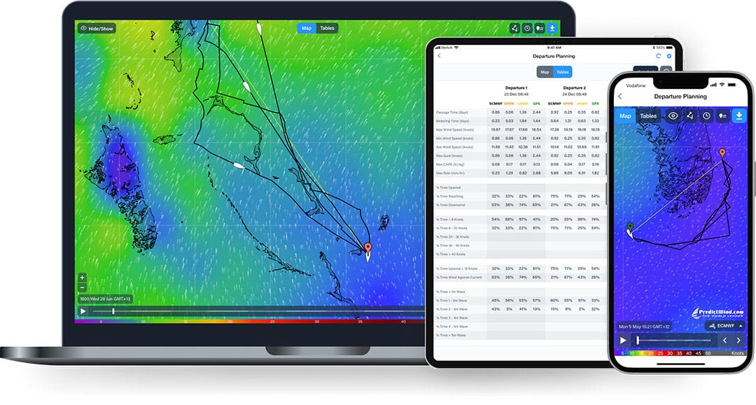
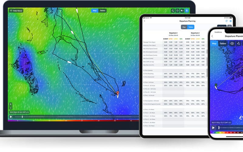
PredictWind
One of the most comprehensive offshore weather routing solutions is PredictWind. In addition to using major weather models like ECMWF and GFS, PredictWind refines forecasts using their own proprietary models, including PWG and PWE. PWG stands for the PredictWind proprietary weather model, which uses the NCEP global initial conditions, processed through the CSIRO CCAM model to generate the PWG forecast. PWE stands for the PredictWind proprietary weather model, which uses the ECMWF global initial conditions, processed through the CSIRO CCAM model to generate the PWE forecast. PredictWind says it is the only private company in the world that has this proprietary technology.
PredictWind CEO Jon Bilger explains: “PredictWind runs these models twice a day globally at 50 kilometer resolution, we then run them at higher resolutions of eight kilometer and one kilometer resolution for popular coastal areas around the world. The high resolution gives a more accurate forecast in near term timeframes. The PWG and PWE are full-model runs from the initial conditions phase, they are not an alteration of the ECMWF or GFS.”
In addition, they offer the SPIRE model. Bilger says “The Spire Model is a privately run model with a unique data set that is fed into the model from their nano-satellite network. We have studied this model and found it to offer a higher degree of accuracy than the ECMWF offshore.”
Similar to Windy, the online website offers a choice of two models to see a graphical animated forecast map. You also get two windows side-by-side to make visual comparison between forecasts. It is sometimes surprising how much variation there is between models!
PredictWind offers an Offshore app for Windows, Mac, IOS, Chromebook, Raymarine, IOS, and Android. The Offshore app is optimized to minimize data when used with satellite communication devices.
Bilger says PredictWind’s Weather Routing Tool is the best in the business. “The routing is calculated on the PredictWind servers doing over a billion calculations. Using the highest resolution data available, this packet of data is then sent back to the vessel in a small file size. The weather router provides critical information about where you will be at any time in your passage, giving all atmospheric data and alerting you to any potential weather hazards with the weather warnings feature where you may have wind against current or potential thunderstorms and many other warnings.”
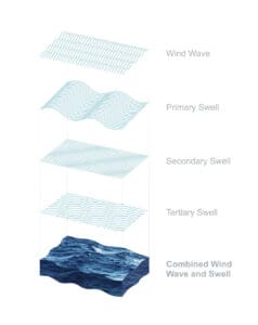
In addition, PredictWind has a Wave Routing tool. “By putting in your basic boat parameters, a model is created which is used in the routing to show how your vessel will react in the wave states encountered throughout the passage,” Bilger said. “Using the Wind Wave, Primary Swell, Secondary and Tertiary Swell [program elements], the roll, vertical acceleration and slamming incidence is calculated for any point on a route, giving boat and life saving data in the extreme, in most situations ensuring a more comfortable and enjoyable passage.”
There are a variety of subscriptions ranging from Basic at $29 to Standard at $249 to Professional at $499 per year. There are also reduced-price three-month subscriptions, which would be handy if you plan to stay near shore and within cell phone coverage for an extended period. McCampbell points out that you need to go for the Professional subscription to get the ocean currents, which is an important layer for many passages.
PredictWind’s proprietary models and tools provide something different, but how well do these models work for sailing passages? Voyager Harley Earl, who sails on a Deerfoot 63, says, “No weather forecasting is perfect. With PredictWind there is sometimes a major disagreement between the models, although that is usually smoothed out by the processing through the algorithms. The models also suffer from a paucity of data in areas where there are few weather stations or ship reports since sailboats sail with the wind and commercial on the rhumbline. Depending on the time of year this can be a bit of an issue for boats crossing in the Pacific or Indian Oceans.”
Expedition
Expedition is an advanced navigation and sailing software package for Windows 10 or 11 that has been used in multiple Volvo Ocean Races, America’s Cup and Grand Prix events.
The company claims it offers “simply the best weather routing available.” The system integrates with all your onboard instruments, and provides multiple routing algorithms, displays of multiple optimum routes, optimal fleet routing, ensemble weather model routing, optimal route sensitivity, wave corrections and avoidance, routing sensitivity, reverse isochrones for graphical interpretation of routing, and asymmetric polars.
A license costs $1,295, and there are optional paid modules for Navico radar and tides and currents in France.
Orca
The folks who produce the Orca chartplotting apps, software, and displays said they talked to a lot of sailors who felt that other route plotting products were too complex and required work to integrate with their chartplotters. In the spring of 2023 Orca introduced Sail Routing to solve these problems.
The company’s website says: “Orca compares thousands of alternative routes to your destination and gives you the fastest route for your boat. To accomplish this, Orca estimates your boat speed based on the forecast wind and tides for all of those thousands of routes before it picks the fastest route.”
In practice, you can choose your starting point and destination and Orca does the rest, and then you can zoom in to get the Details Timeline, which shows predictions of conditions at any point on the chosen route.
This routing choice can be further refined by choosing a polar diagram from the 8,000 profiles available. You can also choose to include information on when you want to commence motoring based on wind conditions. Orca is working on integrating live weather data from your boat’s instruments to further refine the route as you progress.
Sail Routing is only available if you are utilizing the Orca Core ($499), which turns your smartphone or computer into a chartplotter that can make NMEA 2000 connections to other equipment onboard. The Core includes many other functions, including AIS. An annual subscription to Orca Premium is free for one year and then costs $119 per year, and is required to utilize Sail Routing.
OpenCPN
Another choice for those who are more technically inclined is to add the Weather Routing Plugin to the free OpenCPN chart plotting software (see “Using satellite imagery with OpenCPN” in this issue). Various options allow you to download and integrate GRIB files and to utilize a climatology plugin to add in historic data similar to what you get on pilot charts.
Open CPN says, “The Weather Routing plugin creates optimized weather routes using isochrone method and predictive GRIB data or averaged gridded climate data based upon constraint settings, start and finish information, and boat performance, calculated using boat specs or polar data.”
Since the basic OpenCPN software is free and available for Mac OSX, Windows, GNU/Linux, BSDs and Solaris it is worth checking out simply for the chartplotting functions, and it would be fun to play around with Weather Routing too. But, this is one system you want to work with for some time before heading offshore with it. McCampbell says OpenCPN Weather Routing is, “very powerful but too-complicated and too fiddly.”
Analysis paralysis
This points out a problem I have observed where the abundance of information available creates a decision paralysis among cruisers. It is easy to find yourself waiting for one more update, one more weather map, one further model update or tool, or for that perfect weather window that never arrives. It is also easy to be overly impressed with the beautiful graphics, the precise numbers, and the confident lists of data. In reality, weather prediction is still fluid and even when accurate your local conditions can be very different than the generally correct forecast.
After a particularly rough passage from North Carolina to Puerto Rico I did some backtracking on the published weather data and could not find the Force 10 winds and 30-foot seas we experienced that had us running under bare poles and towing a sea anchor. That was prior to today’s weather apps — hopefully they would have helped us to avoid that experience, but there is still a lot of unpredictability in the weather that can’t be erased with technology.
Like any other tool, weather routing software needs to be used with your mind engaged, input data correct, and output data used with experience for your particular boat, crew, and region. n
John Kettlewell recently retired as the executive director of Sail Martha’s Vineyard. He’s cruised the waters between Labrador and South America for more than 45 years.