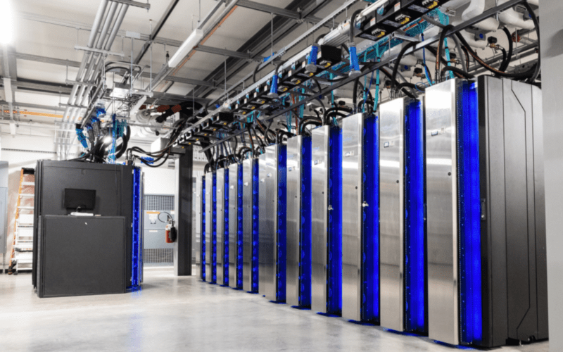
The title might suggest that this newsletter will be about flowering trees and desert succulents. Rather, the title refers to two new supercomputers that NOAA placed into service in late June of 2022. These computers are twins, meaning that they have nearly identical capabilities so that when one needs to be taken down for maintenance or upgrades, there is no loss of operational capability. They are located in separate parts of the country, again, allowing for redundancy in the case of some sort of an issue at one of the sites. They are some of the fastest computers in the world, and are three times as fast as their predecessors. Here is a link to a NOAA press release regarding these new machines.
It is interesting to look back on an occasion like this and marvel at the progress that has been made in the field of meteorology over a relatively short time, just few decades.
I began my career in meteorology during the pre-internet age. In the late 1970s when I was in college, the state of numerical weather prediction (the “computer models”) was much less advanced than it is today. At that time, the longest range computer model output that was available was a 72-hour forecast which was initiated at 8 p.m. each evening, and the output was available at 2 p.m. the next afternoon. The output for that forecast was limited to a 500-millibar forecast. At that time, weather information was delivered mainly by teletype and special fax machines connected to a dedicated telephone circuit. This information was not widely available to the general public. Radar data was much less comprehensive and was generally provided through text messages providing azimuth and range data for precipitation areas which had to be plotted on a chart. Satellite imagery was available only a few times a day with a lag time of several hours between image acquisition and transmission to users. Images , generally sent via the fax circuit, were in black and white, and the resolution was very coarse.
Television graphics at most stations at that time were limited to map boards on which the presenter would use magnetic symbols to denote highs, lows, and fronts, and markers to add comments or show the expected movement of systems. But these broadcasts, and those of radio stations were the main method that most members of the public accessed their weather information. For mariners, there were radiofax services which allowed for the reception of weather information, including charts, and some short wave broadcasts that provided verbal summaries and forecasts. The reception of these services was variable over the open ocean depending on radio propagation. At that time, typically the longest range forecasts that were available through these methods were 48 hours, and often those did not arrive until 12 hours after they were initiated.
There have been steady improvements in weather forecasting capabilities and the ability for the general public to access forecasts since that time. Many factors have contributed to these improvements. There has been considerable research done on atmospheric processes and weather systems at many different academic institutions around the world, and many national meteorological services have been involved as well. Much of this research has been funded by national governments, and the return on the investment has been outstanding. The research has contributed to better warnings for serious weather events such as extreme temperatures, floods, severe thunderstorms, tornadoes, winter storms and hurricanes, all with longer lead times. Over the oceans, warnings of strong winds (gale, storm, and hurricane force) are available farther in advance than ever before.
In addition to the scientific research, there have been significant advances in mathematical modeling as applied to the atmosphere. New techniques have allowed the models to be more accurate, and to extend forecasts farther into the future. The models have also expanded to predict more parameters such as precipitation types and amounts, relative humidity, gustiness of the wind, sea state, and more. Specialized models for hurricanes and severe weather have been developed.
The observation of the atmosphere has improved significantly over the decades as well. In addition to standard weather observations at the surface of the earth, the improvement in satellite observations is almost unbelievable. There are are now many more satellites in orbit for the sole purpose of observing the atmosphere, and the technological and communication capabilities of these instruments allows much more detailed observations of many atmospheric and oceanic parameters and a more rapid transmission of the data back to earth. The latest generation of NOAA satellites can acquire images every five minutes, and these images are available within 10 minutes. Radar technology has also improved with the advent of doppler capabilities and greater coverage. The combination of these newer observation technologies has allowed rapidly developing weather systems to be more closely tracked than ever before, and has also allowed much more comprehensive data to be available for research purposes. Also, the improvement in observations has allowed for a better initial data set to be available for the mathematical models.
Of course, all of the improvements in observing and understanding the atmosphere and in mathematical modeling techniques would not be useful if not for the advances in computer technology. It is the faster and more powerful computers that allow all of these improvements to be put into everyday use. The weather forecasting problem is unique among scientific endeavors because it is perishable. This means that once the initial data (the observations) is gathered, it must be prepared for entry into the computer models, the models must be run, the output generated and analyzed, all in time for the forecast output to be relevant. In other words, if it takes two days to generate a 24 hour forecast, that forecast has no value.
The other major factor in getting the improved weather forecast information into the hands of users has been the revolution in communication technologies. The most consequential has been the advent of the internet. This has allowed all kinds of weather data to become widely available to anyone with a device that has online access. This availability has fostered the development of many websites and apps which are targeted toward specific users, including mariners. This means that satellite images, radar output, and computer model output is now available to just about anyone. Wireless and satellite telephone technology has also contributed to more widespread availability of weather information on land and at sea, and to a more timely delivery of warnings.
And now, enter Dogwood and Cactus. These are just the latest in the computer advances that provide meteorologists with one of their most powerful tools. The computer models will never be perfect, but they are very good. For those of us in the meteorological field who were happy to have the once-per-day 72-hour 500-millibar forecast that took more than 12 hours to produce in the 1970s, today’s models, which are reliably run four times per day with output out to 384 hours available within 4 hours after their initialization, represent an advance in the science that could not possibly have been anticipated at that time. From the point of view of the public, accurate and reliable forecasts five to seven days in advance are now almost taken for granted. Having Dogwood and Cactus as part of the enterprise will undoubtedly contribute to further improvements in the coming years.
Contributing editor Ken McKinley is a weather router for both commercial and recreational clients via his company Locus Weather in Camden, Maine.