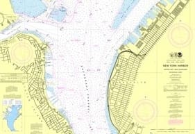
Hurricane Sandy’s most obvious calling card was the blow it delivered to beachside homes in Greater New York, reducing thousands to piles of rubble. But the storm also did a number on New York Harbor, rearranging the sea floor, redrawing shorelines and depositing debris hazardous to navigation.
To help mariners safely transit this redefined world, NOAA’s Office of Coast Survey has fast-tracked a new version of Chart 12334. It’s the first product of a multi-year effort to update nearly two dozen East Coast nautical charts in the wake of the storm.
“It normally takes more than a year, and sometimes four years or more in very complicated cases, to create a new chart edition,” said Rear Adm. Gerd Glang, director of the Office of Coast Survey. “In this case, we were able to use data we gathered to help the repair efforts at the Statue of Liberty, merge it with depth measurements collected by the U.S. Army Corps of Engineers, and push it ahead as a priority since the Port Authority of New York and New Jersey is so essential to the nation’s economy.”
The NOAA team’s efforts included surveying more than 110 linear nautical miles and collecting 578 million depth measurements. The new chart also has updated shorelines based on post-Sandy aerial photography.
Chart 12334 – New York Harbor is available as a print-on-demand paper nautical chart, as a free PDF digital download, and as a free raster navigational chart. To get yours, go to www.noaa.gov.

