Wave height and period are significant factors that voyaging sailors need to take into account when making a passage. This article looks at how waves form and how voyagers can use forecast info to help determine the location of big waves and avoid them.
[gtx_gallery]
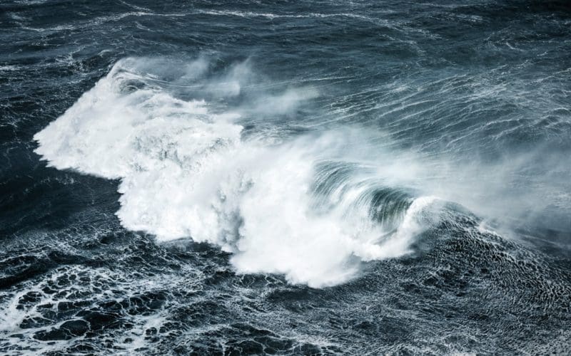
The primary driver for wave generation over the oceans is the force of the wind on the surface of the water. This force displaces surface water horizontally, which also results in a vertical displacement. Gravity then works to return the vertically displaced water back to an equilibrium level, and this leads to waves that propagate along the surface in the direction of the wind.
When the wind begins to blow in a local area, waves form almost immediately through this process, and these waves are termed “wind waves.” They tend to be rather short-period waves that do not get very large and that will fade quickly when the wind drops off. When winds are stronger and persist for a longer time and over a larger area of the ocean, waves can grow to larger sizes and will have longer periods. These larger waves will then propagate out of their generation area and will persist for longer time frames and over long distances. These types of waves are termed “swell,” and they are not affected dramatically by local wind conditions after they have left their generation area.
At any given location, the waves are typically a mixture of locally generated wind waves and longer period swells that were generated elsewhere and have propagated into the region. In some cases, more than one swell set may impact a given area, and this can lead to what is termed a “confused sea.” Because of the range of different wave heights that prevail in a given spot and at a given time, wave heights are described using the term “significant wave height,” which is defined as the average of the highest one-third of all waves present. This definition turns out to agree fairly well with what experienced mariners observe, but because the definition is an average, it means that there will be higher waves present at times. The highest waves that are likely to be observed in any situation are generally accepted to be twice the significant wave height. All marine forecasts that present wave heights, whether in text or graphic form, use significant wave height.
Three factor waves
Ocean waves will grow based on three factors: wind force, duration, and fetch. Fetch is defined as a region over the ocean where winds are blowing in generally the same direction and at the same speed. It is the length of the fetch (along the axis of the wind direction) that is most important. Once a fetch has been defined, it is important to know how strong the winds are in the fetch and how long the fetch will persist. There are nomograms in several different maritime references that will use input of fetch length and wind strength along with the duration of winds of the given strength and provide output of significant wave height and wave period generated within that fetch. There are also mathematical formulas that can be used to determine the wave parameters of interest generated by a fetch. Waves generated within a fetch will propagate out of the fetch and will maintain their periods with only slow decay of their height as they continue moving through the ocean until they reach shallow (usually coastal) waters.
In practice, mariners who are underway are unlikely to use the nomograms and formulas noted above to determine wave characteristics, as they are cumbersome. Also, fetches are typically not static, but rather they move, and there are often multiple fetch areas present in a particular ocean basin. This makes the determination of expected wave characteristics at any given location rather complex. Thankfully, several national meteorological services (like NOAA) routinely perform the analysis and make available to mariners forecasts of significant wave heights in both text and graphic form. But it is worth taking some time to look broadly at the processes that generate ocean waves in order to have a better understanding of how they will impact an area of interest.
Because wind is the primary generator of ocean waves, it is necessary to examine the wind fields present (which are likely to be present in the future) to have an idea of how wave fields will evolve. The easiest way to examine wind fields is to look at surface isobaric pressure charts, since surface pressure differences generate wind. By looking at the isobars on these charts and, in particular, looking for areas where the isobars are reasonably straight rather than curved and are spaced roughly the same distance apart, one can identify fetch areas where wind speeds and direction are consistent.
Fetch orientation
Looking at Figure 1, a surface pressure analysis chart, we can identify a region marked “A” as a fetch off the east coast of the U.S. Note that the orientation of the fetch is not exactly parallel to the isobars — this represents the fact that surface winds tend to cut across the isobars toward lower pressure at a shallow angle. In a similar manner, we can define another fetch to the southeast of the stationary frontal boundary, marked “B” on the chart.
Waves generated by these fetches would likely be higher farther downwind because the effective fetch would be longer. Because the pattern features a stationary front, it is reasonable to assume that the waves would be a bit higher than otherwise expected because the fetch being generally stationary would lead to a longer duration of the wind in that fetch area. By looking at Figure 2, a wind and wave analysis chart valid at the same time as Figure 1, and superimposing the fetches “A” and “B” determined from the surface pressure chart, it can be seen that the observed significant wave heights line up fairly well with expectations.
Looking ahead and examining the 24-hour forecast products, it can be seen by looking at the surface forecast chart (Figure 3) that the isobaric pattern was not forecast to change that much, so the fetches will remain nearly stationary. On the corresponding wind and wave forecast (Figure 4), notice that the significant wave heights off the east coast are forecast to be a bit higher, likely owing to the longer duration of the fetch. The wave heights associated with the fetch to the east are not forecast to be any higher, and this may be due to the fact that a fully developed sea may already be present in this area.
A fully developed sea is the highest that the waves can get for a given wind speed, fetch length, and duration. In other words, once seas reach this level, they will not grow any higher even if the duration is longer. Of course, if winds were to increase, or the fetch were to become longer, this would allow for higher waves.
Moving to the 48-hour forecast products, first note that the charts are full ocean charts rather than the regional charts for the analysis and 24-hour forecast products. Note specifically that full ocean wind and wave charts provide significant wave heights in meters rather than feet. Examining the 48-hour surface forecast (Figure 5), we see that the stationary front is still in place off the east coast of the U.S. but the isobars to its north are farther apart with the high to the north not as strong, and this suggests that wind speeds in the fetch previously defined will not be as strong. Examining the corresponding 48-hour wind and wave forecast (Figure 6), we see that the significant wave heights in this region are forecast to top out at two meters (a bit more than six feet), not as high as indicated on the 24-hour wind/wave forecast chart.
Containing the most energy
Wave period and direction forecast charts provide additional information about ocean wave fields. These charts show the wave period (in seconds) and the swell direction of the peak waves –– that is, the waves (generally swells) that contain the most energy. Sometimes there is more than one swell field impacting a given area, and local wind waves are also present, and the data on these charts does not give information about these other waves. Still, by combining the information on these charts with the information on the corresponding wind/wave forecast charts, the mariner can get a more complete picture of the wave field. Figure 7 is the 48-hour wave period and direction chart that corresponds to Figure 6. One can see that the primary wave direction along the east coast of the U.S. is from the east with wave periods in the six- to eight- second range. The wave direction farther to the east (toward 60° W) is more from the southeast. Note that in the eastern portion of the Atlantic, west of the British Isles, this chart shows an area of longer period swells propagating toward the southeast. Referring to the wind/wave forecast chart valid at the same time (Figure 6), it can be seen that the winds in this area do not line up with the swell direction. This is a good indication that the primary swells in this region were generated at an earlier time from a fetch that is no longer present. Also, the wind wave chart suggests that the significant wave heights in this region are not unusually high. It is important to understand that long-period swells are not necessarily high waves.
Wave period and direction forecast charts are quite helpful in determining when larger waves generated by a distant fetch area will arrive at a given location. The leading edge of a swell set is termed a “wave front” and can be identified by noticing a dramatic change in the swell period (see Figure 7). Tracking wave fronts on successive wave period and direction forecast will help to time their arrival in a particular area of interest. In the case of strong winter storms in the North Atlantic, for example, swells that are generated by the storm’s isobaric pattern will propagate many hundreds of miles away from the system, and in situations like this, large swells can impact Puerto Rico and other Caribbean islands from the north even though the winds in that region may not be unusually strong.
Another situation where large swells can propagate a long distance from a weather system occurs with stronger hurricanes. In fact, often during the hurricane season, the wind fields across the oceans are rather weak except around the hurricane itself. Hurricanes are more compact systems than winter storms, and thus their circulations do not produce very long fetches. But the wind speeds are very strong, so large waves can still result. As these systems move, their fetches move as well, and the effect is not unlike dropping a stone in a small pond with waves rippling out from the place where the stone enters the water. When the short fetches are moving in the same direction as the wind in the fetch, a phenomenon known as dynamic fetch occurs, leading to an effectively much longer fetch as the building waves remain in the fetch as it moves along. This can lead to some very large waves.
A couple of charts from September of 2020 illustrate wave fields generated from tropical cyclones very well. Figure 8 is a 48-hour wind and wave forecast chart, and Figure 9 is the corresponding wave period and direction chart. Major hurricane Teddy was forecast to be located in the western Atlantic at the time of these charts with maximum significant wave heights of 14 meters (nearly 46 feet). The wave period and direction chart shows swells propagating out ahead of the hurricane, and the wave front is obviously approaching the eastern U.S. Subsequent wave period forecast charts would show when this wave front (and thus the larger swells) would arrive in U.S. coastal waters. Looking in the eastern Atlantic, a large area of long-period swells is shown impacting western Europe and northwestern Africa. These swells are from hurricane Paulette, which had tracked through the central Atlantic a few days prior to the valid time of these charts, but was a weaker system by the valid time of the charts. Its wind circulation is evident on the wind and wave chart southwest of the Azores. This situation shows how far the swells can propagate away from a tropical cyclone and how long they can last.
Wave conditions are one of the most impactful factors in any ocean passage, and understanding what to expect is critically important in the voyage planning process. n
Contributing editor Ken McKinley is the founder of Locus Weather(locusweather.com), which provides meteorological analysis and weather routing services.