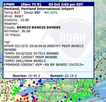
Attention users: The NOAA and National Weather Service (NWS) have created a web-based touchscreen weathermap that is accessible through devices such as the iPhone or iPad, or similar smart phones and tablets.
Using a cursor or touch motion, a user may scroll over a given region in the map of the US and find up-to-the-minute weather information such as tempurature, cloud formation, windspeed, humidity and altimeter readouts via airport radar. The map can be zoom-specified to fit particular states, and even their particular regions. These elements might be crucial for a captain setting course either from shore or at sea, as it gives him/her the appropriate readings for the weather’s severity and direction. In conjunction with a working radio, it could save lives before they are endangered.
Here is the link for this new weathermap: http://www.wrh.noaa.gov/zoa/mwmap3.php?map=usa

