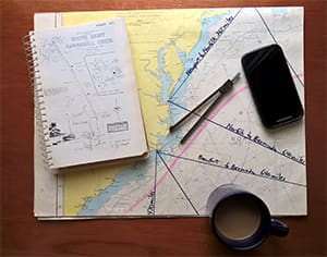
Of course chart printers and digital charting companies want you to keep purchasing new charts. Who wouldn’t want the latest charts? Other than cost and hassle, there is no reason not to go with the latest stuff, but keep in mind the usefulness of “old charts” and alternative charts found in guidebooks.
Many of you reading this won’t remember the days when “updated charts” meant hand-drawn corrections painstakingly culled from a giant stack of Notices to Mariners. Chart sellers catering to commercial vessels had staff that did almost nothing but constantly update paper charts by hand. In chart stores you could purchase stick-on chart symbols and drawing aids so you could sketch little buoys on your charts. There were even packets of stick-on compass roses. Cruisers generally treated their charts like heirlooms, with each scribbled notation considered “patina” and a remembrance in ink or pencil of adventures past. Sadly or not, the era of such hand-updated charts is over.
Update your ones and zeroes
One huge advantage of using digital charts is the ease of doing so. It can be as simple as purchasing a new card for your plotter, or signing up for an update program or even just logging on to an online service. For example, Navionics claims to make 2,000 chart updates every day to their flagship Nautical Chart product. For chartplotters, you download the updates through “Freshest Data,” which is free for one year. You can also take your plotter card to a dealer for updates. The Navionics WebApp lets you view the latest charts online, which is great for planning purposes.
Similarly, Garmin has an online system called Garmin Express for updating some of their marine charting products, while others allow you to update at a dealer or swap for a new chip. When shopping for any marine digital charts, keep in mind what the update process involves and the cost after the typical one-year included update. Is this a process you might be able to do when sailing the South Pacific, and where are dealers or shipping points if you will need new charts later in your travels?
C-Map by Jeppesen, as part of the Alliance for Safe Navigation, makes available a “Boat Smart” document that is worth sending for, as it explains how changes on the water can impact your charts. This whitepaper also includes information on boating accident statistics from the Coast Guard, with the bottom line being that many events, such as groundings, occur because of the lack of up-to-date charts — or in some cases, no charts at all!
This brings up another issue: Charts are not always available when you need them. Plan ahead! You can be just about guaranteed not to find local charts right before a busy holiday weekend, and with many fewer outlets for official NOAA charts you may be forced to purchase a plastic laminated fishing map, better suited as a placemat for your dining table at home. Luckily, with digital chart regions being quite broad, it is easy to carry a large number of charts on board. Be vigilant about the borders between chart regions; I have found myself suddenly sailing off the chart at times!
Free stuff your taxes paid for!
Of course, in the U.S. you can view and download any official NOAA chart in ENC, raster, or in some cases PDF format direct from the government. The ENC and raster charts can be utilized by many PC charting programs. Since these are free to download, but the process takes some time and the files are large, this makes for a great winter project for those of us limited to a summer boating season. This is not something you want to do over a limited and slow cellphone data connection!
Mix and match
In practice, I use a combination of obtaining updated digital charts for my PC at home for planning, my chartplotter on board, and even my phone. But I also maintain and use an extensive library of old paper charts with my own invaluable notes and “local knowledge” written all over them. I prefer to use ballpoint pen on my charts so the markings and notes last a long time. I still use pre-plotted offshore courses on large planning charts that are 30 years old. Old offshore charts are generally quite safe to use due to the lack of anything to hit!
Updated cruising guides, including harbor chartlets, are great companions to your digital and paper charts. Using guidebooks for harbor approach charts is often easier than peering into the chartplotter or struggling with a big paper chart, and the guidebook charts often contain useful information like pre-plotted courses, landmark/facility updates and photos. Purchase some big two-gallon zipper-type plastic storage bags at the grocery store for waterproofing your guidebooks for the inevitable approach to the dock in the pouring rain!

