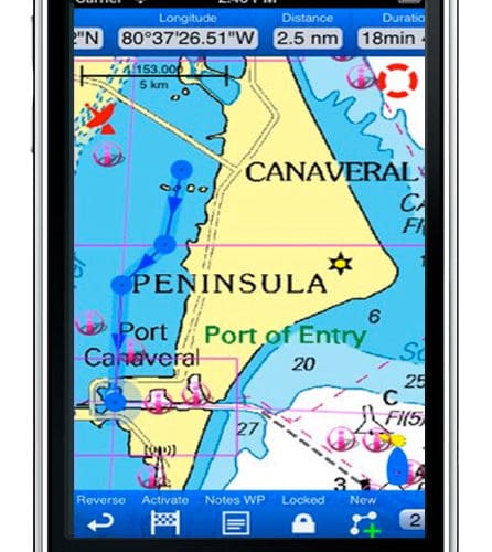
NV Charts has released a new free chart app for iPhone, iPad, Android, Windows 7/8 and Mac OSX. Go here for links to download the app for different platforms. According to NV, the idea behind the app was "to develop an app that works on all platforms and that looks and functions in the same way, regardless of the hardware used." This version is officially a beta release. NV plans to continue app development using input from users and to integrate geo data and social networking.
"The most important content for a navigation app are charts, followed by harbor and anchorage information, service facilities, supplies up to guidebook information for the local environment. But the user is also able to add own content, i.e. photos,infos and texts from his trip. This information is available as geo-data, meaning the information is exactly available and saved at the chosen position or harbor and clickably displayed. This geo-data is constantly reviewed and editorially revised and online available on our nv server for download. During your trip the downloaded geo-data is available offline on your system. The nv server can be used as data storage for tracks, notices, photos etc., available everywhere and at all times by any internet device accessible via an registered, password protected account."
Beta version features:
• Easy downloadable charts
• Always up-to-date charts
• Smooth & synchronized navigation on
all devices, by using the nv account
• Seamless chart displaying
• Free zooming and shifting of charts
• Position via GPS or Wifi
• Intuitively route/trip planning
• Track recording, waypoints,
range and bearing lines
• Geo content / Location based
service as Harbor information,
guidebook, nv-pedia
• Lighthouse sketches
• Instruments
• Course, speed, cruising mode