A few days before Thanksgiving, the antenna on a satellite 500 miles above the earth slowly ground to a halt &mdash worn out from 10 years of continuous use. When the antenna stopped, winds on vast areas of the world’s oceans became more of a mystery to forecasters. The frozen antenna means NASA’s QuikScat satellite is no longer able to measure winds at sea &mdash as it had done flawlessly for eight years beyond its expected life. Meteorologists have lost a key component of their forecasting suite. Now forecasters must rely on other, less capable spacecraft for gathering wind data. QuikScat’s loss will affect the accuracy of marine forecasts, especially those for the more remote areas frequented by ocean voyagers.
Determining winds across the breadth of the world’s ocean is a daunting task. Data from ship reports is limited to the regular, narrow paths trod by the world’s commercial fleet. Vast areas are rarely or never visited by ships. Using buoys to gather wind data would require a fantastically expensive array of buoys that would further require constant funds for maintenance and repair.
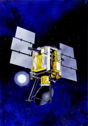
The most cost-effective solution to gathering this data is via satellite, using a technique called radar scatterometry. Since its launch in June 1999, the QuikScat satellite has been reliably providing wind data for 90 percent of the oceans’ surface.
While radar scatterometry dosn’t sound like something most of us would have any experience with, the truth is that any mariner who has a radar on his or her boat is familiar with the technique. Radar users know that when the wind is blowing hard and the waves are up, they see a band of radar reflections close in around their boat. This is called “sea clutter” and represents radar echoes being scattered back to the radar from nearby waves. The higher the wind, the bigger the waves and the more “scatter” back to the radar. The radar scatterometer on QuikScat uses the same basic principle: it paints the ocean with a radar signal, the greater the return, the faster the wind is blowing at the surface.
When it was working, QuikScat could scan a 1,100-mile-wide swath during each orbit and provide approximately 90 percent coverage of Earth’s oceans every day. The QuikScat instrument used a 110-watt, pulsed, Ku-band radar signal at 13.4 GHz. The satellite’s 3.25-foot rotating antenna produced two spot beams that swept the surface in a circular pattern.
QuikScat was operated by NASA’s Jet Propulsion Lab (JPL) in Pasadena, Calif. Mission controllers at JPL initially hoped to get QuikScat’s antenna rotating again, but that possibility seems to be fading. “We haven’t identified any viable approach to restart the antenna rotation on QuikScat,” wrote Rob Gaston via e-mail &mdash Gaston is QuikScat’s project manager at JPL. “While there are some things that we could try, the probability of success is so low and the associated risks are high enough that we’d rather not attempt any of them at the moment. We are currently continuing to collect scatterometer data that will enable us to cross calibrate QuikScat with other sensors.”
According to Joe Sienkiewicz, acting chief of the Ocean Applications Branch of the Ocean Prediction Center in Camp Springs, Md., QuikScat wasn’t perfect. “[It] had real limitations in areas of moderate to heavy rain.” However, Sienkiewicz also credits QuikScat for increasing forecasters’ awareness of hurrican-force winds in extratropical cyclones (storms that originate in the mid-latitudes rather than in the tropics such as hurricanes and tropical storms). “Through confidence gained from QuikScat,” Sienkiewicz said in a recent NASA article, “the National Weather Service began issuing warnings for dangerous hurricane-force winds in extratropical cyclones in December 2000.” QuikScat data has given forecasters new insight into mid-latitude storms. “From 10 years of QuikScat, we have learned that hurricane-force winds in extratropical cyclones occur more frequently than thought, are most frequent in winter months, and the conditions are most often observed south of the cyclone center,” Sienkiewicz said.
Now that QuikScat is inoperative, forecasters are learning to get along without it. “We are sharpening our satellite interpretation skills for cloud imagery,” Sienkiewicz wrote in an e-mail, “and relying more on numerical model interpretations of the wind field over the oceans. We know from our QuikScat experience that these do have errors. The hard part is that we have, for the most part, greatly reduced our ability to verify our wind warnings and, unfortunately, most significantly for the stronger storms.”
Even though QuikScat long outlived its two-year design life, NASA does not have a follow-on spacecraft ready to go to replace QuikScat. As a result, U.S. forecasters are relying on spacecraft from other nations, none of which can quite match QuikScat’s capabiliites.
The European MetOp-A satellite has a radar scatterometer package aboard, called ASCAT, which is the world’s first operational scatterometer (QuikScat was technically a research instrument) put into orbit. It provides less coverage, has a different configuration of spot beams and doesn’t have as fine a resolution as QuikScat, however.
The National Oceanic and Atmospheric Administration is also in discussions with space agency Indian Space Research Organisation, to gain access to data from a research scatterometer aboard an Indian satellite launched in September 2009. According to Sinekiewicz, the Indian effort was designed to download data only during passes over an earth station in Indian territory. So some reconfiguration of the Indian operation would be required for U.S. forecasters to use the satellite’s data. “We are hoping that this scatterometer on the Oceansat-2 satellite would help fill the gap left by the loss of QuikScat,” said Sienkiewicz.