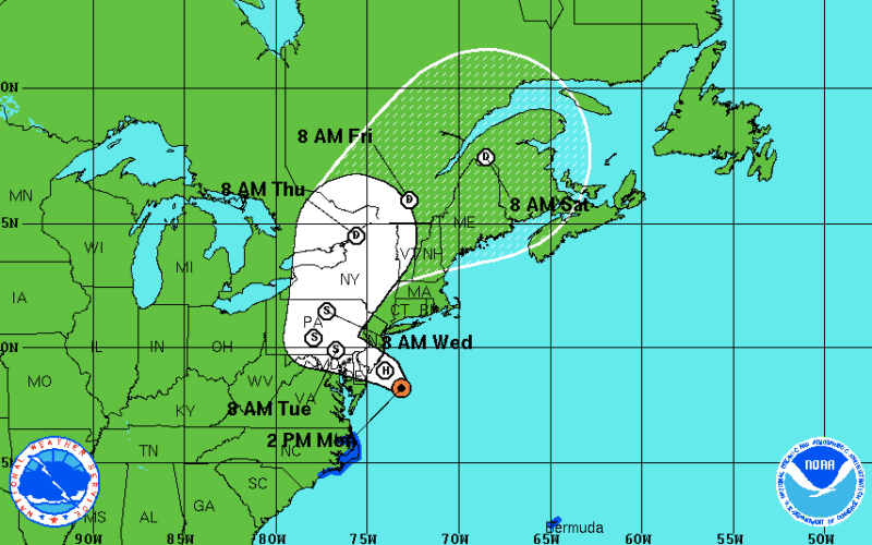
Check out this animation of the NOAA/NWS forecast maps for Hurricane Sandy. Watching this really drives home the hard left turn Sandy made into the East Coast of the U.S. The more likely route for a storm this far offshore would be to miss the U.S. entirely. Due to the Coriolis effect, tropical storms/hurricanes are more likely to bend their path to the right and head out across the Atlantic.
Uncategorized
Intriguing Hurricane Sandy animation

