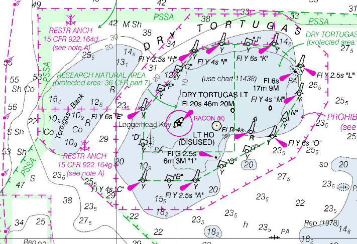
NOAA's Office of the Coast Survey has published a new international chart for navigation between Florida and Cuba. If the chart looks a little different from what you're used to seeing from NOAA, there's a reason for that. The chart has soundings in meters, which many international mariners use rather than fathoms and feet the U.S. chart standard. The chart also uses some international symbols not found on charts produced for U.S. mariners.
From the press release: International mariners entering U.S. waters around southwestern Florida now have a new international (INT) nautical chart to help ease their transit, NOAA's Office of Coast Survey announced today. The new chart, INT 4148, has the same information as Chart 11420, Havana to Tampa Bay, but the depictions are converted to the metric system. (Most U.S. charts use either feet or fathoms for depth measurements). INT chart symbology can also differ from U.S. charts, so Coast Survey has made those modifications as well.
Starting in April, INT 4148 will be printed on the reverse side of Chart 11420. The new chart will soon be available as a print-on-demand chart.
In 1971, the International Hydrographic Organization adopted the idea of a common, worldwide chart series (INT Charts) produced to a single set of agreed specifications. IHO encourages countries to publish INT charts, and to make them available to hydrographic offices from neighboring countries, so they can use them for comparison or compilation with their domestic charts. Regional Hydrographic Commissions coordinate the production of INT charts. This particular chart was coordinated by the Meso-American and Caribbean Sea Hydrographic Commission – where NOAA experts are committed to supporting international hydrographic cooperation.
NOAA's Office of Coast Survey, originally formed by President Thomas Jefferson in 1807, updates the nation's nautical charts, surveys the coastal seafloor, responds to maritime emergencies and searches for underwater obstructions and wreckage that pose a danger to navigation. Join Coast Survey on Twitter @nauticalcharts, and check out the NOAA Coast Survey Blog at http://noaacoastsurvey.wordpress.com for more in-depth coverage of surveying and charting.
On the web:
NOAA Office of Coast Survey: http://nauticalcharts.noaa.gov
NOAA Chart 11420:
http://www.charts.noaa.gov/OnLineViewer/11420.shtml
NOAA INT 4148: http://www.charts.noaa.gov/OnLineViewer/4148.shtml
IHO INT Charts webpage:
http://www.iho.int/srv1/index.php?option=com_content&view=article&id=312&Itemid=670


