 |
iNavX and Boat US are working together to enhance boater safety by making sure that everyone on the water has access to a readily available navigation device. Mobile navigation helps boaters plan their trips and navigate accurately once they are on the water. iNavX provides Boat US members a convenient and affordable MFD that can fit in their pocket.
As a further benefit all Boat US members receive exclusive savings on all charts and data services in iNavX. This program ensures Boat US members have access to iNavX, the #1 marine navigation application. Having charts, weather, AIS, and a fully functioning chart plotter they can take with them, will help Boat US members enjoy being on the water no matter where they go.
“Working together, Boat US and iNavX will keep boaters safe and informed adding to their enjoyment on the water,”
Explains Shaun Steingold, General Manager of iNavX.
“At Boat US we are always looking for new and better ways to provide value to our members. Giving Boat US members discounted access to advanced navigation tools like the iNavX chartplotting app keeps them on the water and safely having fun,”
Says Elio Betty, Publisher of Boat US Magazine.
The Boat Owners Association of The United States (Boat US) is the nation’s largest recreational boating advocacy, services and safety group, making boating better for America’s recreational boaters since 1966. They provide a voice for boat owners and fight for their rights on Capitol Hill. They keep boaters safe with their marine insurance and TowBoatUS programs, and keep waters clean with assistance from the nonprofit BoatUS Foundation. They provide services and benefits to over half-million active Members which include marine insurance, towing, boat loans, boat striping and lettering, and special discounts on products and services like the iNavX program.
www.BoatUS.com
iNavX, innovators of the leading marine chart plotting app, by teaming up with Boat US, provide their members with state-of-the-art electronic navigation tools. All mariners should be versed in traditional navigation, especially when going offshore, but modern boaters should also understand electronic navigation. Modern electronic navigation systems like the iNavX app help boaters plan and prepare for their voyages and stay on track while underway. iNavX is the only marine navigation app to offer a full suite of worldwide charts from multiple chart providers that include NOAA raster charts, Navionics vector charts, Blue Latitude, Explorer Bahamas, Waterway Guides, CHS Canadian charts, and Delius Klasing charts for Europe. Boaters gain a better understanding of their cruising area using these multiple in-app chart formats. Advanced features of iNavX like Theyr weather, and AIS further increase boater safety and satisfaction.
www.iNavX.com
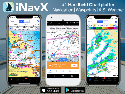
iNavX transforms popular phones and tablets into full functioning, handheld chartplotters. Sophisticated navigation functions can be used anywhere in an easy to use app. Location, Heading, Speed, COG, Waypoints, Routes and other navigation functions are attractively displayed on the device. Advanced features include high-resolution weather overlays and AIS data that are easily activated within the app. Access to worldwide charts from leading chart providers in iNavX and its full suite of MFD features lets boaters navigate safely and effectively on any boat anywhere in the world. Planning trips and setting routes can be done remotely, alleviating the need for boaters to access their vessel and enter coordinates into sometimes cumbersome onboard plotters. Multiple devices can be accessed allowing the user to pull up their iNavX navigation functions and full suite of charts on their smart phones as well as tablets. iNavX is fully compatible with both iOS and Android devices and is available as a simple download from the Apple App Store or Google Play Store.
