NOAA recently released 3-D sonar maps and images of a passenger ship lost more than 100 years ago in what many consider the worst maritime disaster in San Francisco history.
On Feb. 22, 1901, in a dense morning fog, the SS City of Rio de Janeiro struck jagged rocks near the present site of the Golden Gate Bridge and sank almost immediately, killing 128 of the 210 passengers and crew aboard the ship. Fishermen in the area responded, rescuing 82 survivors, many of whom were plucked from makeshift rafts and floating wreckage. The dead included Chinese and Japanese immigrants as well as the U.S. Consul General to Hong Kong, who was returning to the U.S. with his wife and two children.
NOAA’s Office of National Marine Sanctuaries Maritime Heritage Program is engaged in a two-year study to discover and document shipwrecks in Gulf of the Farallones National Marine Sanctuary and nearby Golden Gate National Recreation Area.
 |
|
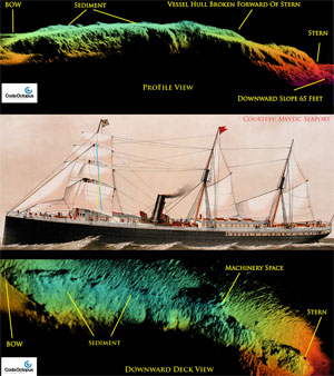
Sophisticated Echoscope sonar, above right, produced images showing the steamship wreck near the Golden Gate Bridge. |
|
NOAA |
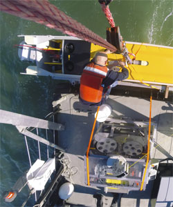
In November, Hibbard Inshore, ROV specialists and Bay Marine Services donated a research vessel and crew, along with a high-powered remotely operated vehicle, to help NOAA pinpoint and map the City of Rio de Janeiro wreck site using three-dimensional Echoscope sonar developed by Edinburgh, Scotland-based Coda Octopus, a manufacturer of geosurvey instruments.
“This exploration of the San Francisco Bay is about our overall efforts to learn about the area’s important marine heritage, as well as to test recent advances in technology that will allow us to better protect and understand the rich stories found beneath the Bay’s waters,” said James Delgado, director of maritime heritage for NOAA’s Office of National Marine Sanctuaries.
 |
|
NOAA |
California-based salvors discovered City of Rio de Janeiro in the 1980s, but its exact location was unknown. The wreck's coordinates did not coincide with any wreck charted by NOAA through years of sonar work. During this recent expedition, Robert Schwemmer, West Coast regional maritime heritage coordinator for NOAA’s Office of National Marine Sanctuaries, worked with Delgado and multibeam sonar expert Gary Fabian to locate the wreck site again. They found the site 287 feet deep, positioned inside the main ship channel, and largely buried in mud.
Schwemmer and the Hibbard team captured the first detailed sonar and three-dimensional images of City of Rio de Janeiro resting in waters just outside the Golden Gate Bridge.
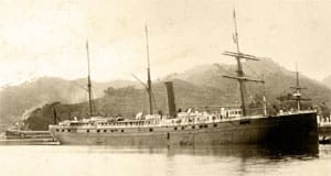
City of Rio de Janeiro, launched in 1878, joined the fleet of the Pacific Mail Steamship Company, carrying passengers and freight to and from San Francisco, Honolulu, Yokohama and Hong Kong after the Civil War. Most Americans whose ancestors came to the United States from the Far East in the 19th and early 20th centuries arrived on ships like City of Rio de Janeiro.

