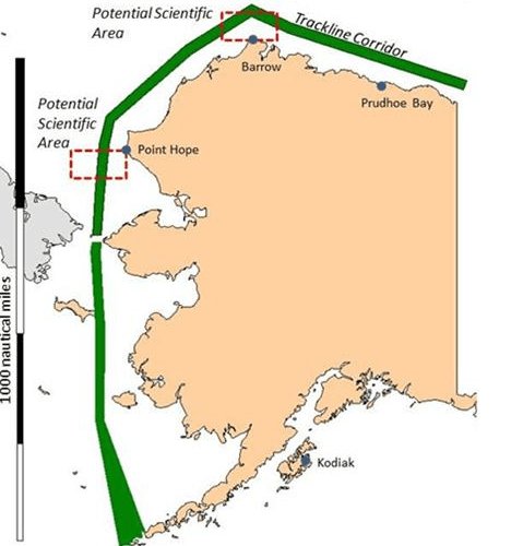
It turns out that the hydrographic data currently used to navigate the Trackline Corridor of coastal Alaska is out of date. The last notable measurements of the coastal corridor were made by Capt. James Cook (read: "1778"). This has inspired the NOAA Office of Coast Survey (OCS) to launch a crucial month-long mission to gather depth data on the region for future charts.
The Coast Survey ship Fairweather has embarked on a 30-day survey that will cover waters from Dutch Harbor, Alaska, through the Bering Strait and northeast to the Canadian border. The goal of the survey is to use collected water-depth information to direct further research for the Arctic Nautical Charting Plan (ANCP). The ANCP was enacted by the Coast Survey in order to ensure the shipping lanes, approaches and ports of the Alaskan coast.
Kathryn Ries, acting director of the OCS, stated, "We expect more increases of Arctic maritime traffic due to melting sea ice, which will require accurate and precise navigational data… The coast length of 921 nautical miles is really 2,191 miles of low tidal shoreline once you figure in the bays and inlets…" But all charting duties require the information sought by Fairweather.
Said her Commander, James Crocker (also the chief scientist of the mission), "A tanker, carrying millions of gallons of oil, should not be asked to rely on measurements gathered in the 19th [or 18th] century." Although that is not always the case, it is a fact that a significant amount of the current OCS charts use data gathered from smaller private vessels: Not only is, and was their equipment relatively unreliable, their data cannot be tracked to a exact location.
In essence, Fairweather's mission will lluminate what the NOAA has deemed a highly dangerous collection of old sailor's tales.