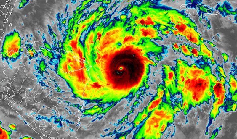
As the June to November hurricane season evolves, attention will gradually focus on certain conditions of both atmosphere and ocean — six specific factors, or “ingredients.” Not only are these factors necessary, but their timing needs to be synchronized to cook up a cyclone. A number of those “ingredients” can be affected by the status of ENSO, a known, periodic, irregular (two to seven year cycle), tropical climactic seesaw of atmospheric pressure, sea surface temperature and winds. Finally, an unanticipated factor may appear that warps model predictions of a potential storm’s genesis, intensity and track – an effect sometimes dubbed the “Butterfly Effect.”
The first four factors directly relate to both the availability of an adequate source of thermal energy and a means of its transport The last two relate to the storm structure itself and affect its growth, intensity, track and decay, etc.
1. Warm water (80°F / 27°C) to a depth of at least 150 feet and at a substantial distance ahead of the storm’s track. Without this warm water the storm is stifled and suffocates.
2. Relatively moist air near the mid-level of the troposphere (about 15,000 ft.) provides the environment for latent heat transfer via vaporization. This is critical since moist air available for evaporation is the “deposit” made within the energy transport cycle to be “withdrawn” later at altitude when energy is released by condensation, yielding not only precipitation but the bonus of heat, a positive feedback supporting the low pressure and continued convection.
3. Teaming up with No. 2 is an unstable atmosphere that cools with altitude. The temperature gradient results in density contrast and given the right conditions, promotes condensation, releasing that latent energy, leading to ingredient No. 4.
4. A pre-existing disturbance and thunderstorms can be a source for cyclonic development. As they converge, and close isobars, the process provides the focus of convective uplift and slight shear to provide the cyclonic spin necessary to feed convection and further reduce central pressure. Note that the formative stage of a tropical cyclone benefits from “just enough” shear to trigger the process, but at altitude, shear becomes destructive to the storm as it tilts and essentially disconnects that “chimney,” choking off convection.
5. Generally, a minimum distance of at least 5° latitude (N or S) from the equator in order to employ the necessary spin made available from the Coriolis Effect (CE) that increases with latitude. The gradual arcing of the storm’s track along the lines of W/NW/N and finally NE is the result of the increasing CE with latitude.
6. Low values of vertical wind shear. Vertical shear being a change in wind speed, direction or both with altitude. (The axis of change is vertical — the change itself is horizontal.) In a system dependent upon convergent transport (inward) and convective movement (upward), a substantial change in horizontal wind speed with height is disruptive to convection (see No. 4 above). One effect of the La Nina pattern in the Atlantic Basin is a reduction of wind shear as happened in 2020.

