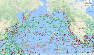
There are two sides to the marine weather data equation: one is gathering data, and the other is disseminating that data to users. There is an interesting new concept being discussed by marine communications and weather experts that involves using a combination of automatic weather sensors on board commercial vessels in conjunction with the automatic identification system (AIS) to gather and send real-time weather data from ships. With such a system, a voyager’s AIS unit could display local weather data as recorded by ships in real time. This could benefit voyagers when they are in shipping lanes, as they could observe real-time data from nearby commercial vessels and thus get a granular look at local and approaching weather. Another benefit would be a larger dataset of raw weather info from ocean areas, which could greatly assist forecasters.
Recently, at the 2018 Ferry Safety and Technology Conference held in New York in March, two presentations were given that highlighted this concept of local real-time weather via AIS. One was by Joe Sienkiewicz, chief of the Ocean Applications Branch at NOAA’s Ocean Prediction Center, and the other from Catherine Lawson from SUNY Albany. Both presentations touched on the value of the AIS-based approach. In addition, the National Transportation Safety Board (NTSB) report on the El Faro sinking contained a section on the value of automated weather sensors linked with AIS for dissemination.
“The oceans remain relatively data sparse for weather observations compared to land areas,” said Sienkiewicz in an email. “Using AIS messages to transmit weather observations, from either automated instruments or manually observed by vessel crews, has the potential to reduce the data gaps in the oceans. This additional information could raise situational awareness for forecasters and benefit numerous forecast models by helping to better define the state of the atmosphere.”
There is already a system for gathering weather data from commercial vessels, but only a fraction of vessels at sea participate, and an even smaller fraction of those that do use automated equipment for the task. Most ship reporting is still done via crewmembers recording the information manually and sending it via radio. By requiring that all commercial vessels larger than a certain size carry automated weather sensors — much as they are all required to have AIS — the volume of weather data from ocean areas could be greatly increased. This data could be disseminated via AIS to satellites and then to weather forecast agencies like the National Weather Service. An automated system like that would help improve forecasts simply by providing more ocean area data.
From the NTSB’s El Faro report: “According to the Joint World Meteorological Organization/Intergovernmental Oceanographic Commission Technical Commission for Oceanography and Marine Meteorology, only a fraction of the number of ships that could provide regular weather reports actually do so. … Meteorologically, ships can provide critical ground truth for buoys and satellite data. In addition, weather observations from vessels can be assimilated into global weather models, which provide key guidance to all weather forecasters. … Also, according to the Environmental Modeling Center, observations from vessels are an important input for weather models because they provide data from locations that satellites might not cover for extended periods. Such a situation can occur, for example, when prolonged cloud coverage exists over a region, prohibiting satellite retrieval of sea-surface temperature.”
The report cited an example of a single ship report that was crucial: “The Ocean Prediction Center (a division of the National Weather Service) gave a recent example of the upgrading of an existing gale warning to a hurricane warning based on one weather report from a ship that encountered 70-knot winds southeast of Newfoundland. Although that particular storm structure had initially looked impressive in satellite imagery, Ocean Prediction Center forecasters had not expected hurricane-force winds at that time of year. The in situ report from the one ship provided critical evidence to the contrary.”
The macro-level benefits are important, but so are those on the local level, where voyagers can get an “early warning” report from nearby vessels when conditions are ramping up faster than the forecast might suggest. The NTSB El Faro report cited an example of a vessel traveling off the U.S. East Coast when it encountered 100-plus-knot winds, despite the weather forecast predicting winds of only 65 knots: “During the event, the bridge crew did not send manual conventional weather reports because they were busy responding to the developing situation, and the ship’s AIS was not calibrated to automatically send weather reports. Nevertheless, other vessels in the region — especially those headed toward the storm — could have greatly benefited from such a real-time, in situ warning.”
In the recommendations section of its El Faro report, the NTSB suggested a system of sending weather via AIS. Perhaps someday soon ships will provide this valuable weather data.